Traînel
Traînel | |
|---|---|
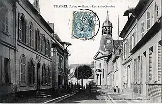 St Antoine street in Traînel | |
 Coat of arms | |
Location of Traînel | |
 Traînel  Traînel | |
| Coordinates: 48°24′56″N 3°26′30″E / 48.4156°N 3.4417°E | |
| Country | France |
| Region | Grand Est |
| Department | Aube |
| Arrondissement | Nogent-sur-Seine |
| Canton | Nogent-sur-Seine |
| Intercommunality | Nogentais |
| Government | |
| • Mayor (2020–2026) | Didier Droy[1] |
Area 1 | 19.99 km2 (7.72 sq mi) |
| Population (2022)[2] | 1,064 |
| • Density | 53/km2 (140/sq mi) |
| Time zone | UTC+01:00 (CET) |
| • Summer (DST) | UTC+02:00 (CEST) |
| INSEE/Postal code | 10382 /10400 |
| Elevation | 66–154 m (217–505 ft) (avg. 74 m or 243 ft) |
| 1 French Land Register data, which excludes lakes, ponds, glaciers > 1 km2 (0.386 sq mi or 247 acres) and river estuaries. | |
Traînel (French pronunciation: [tʁɛnɛl]) is a commune in the Aube department in north-central France.
Population
| Year | Pop. | ±% |
|---|---|---|
| 1962 | 818 | — |
| 1968 | 844 | +3.2% |
| 1975 | 829 | −1.8% |
| 1982 | 853 | +2.9% |
| 1990 | 847 | −0.7% |
| 1999 | 983 | +16.1% |
| 2008 | 1,036 | +5.4% |
| 2012 | 1,070 | +3.3% |
See also
References
- ^ "Répertoire national des élus: les maires". data.gouv.fr, Plateforme ouverte des données publiques françaises (in French). 2 December 2020.
- ^ "Populations de référence 2022" (in French). The National Institute of Statistics and Economic Studies. 19 December 2024.
Wikimedia Commons has media related to Traînel.