Tignieu-Jameyzieu
Tignieu-Jameyzieu | |
|---|---|
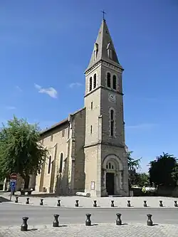 The church of Saint-Antoine, in Tignieu-Jameyzieu | |
Location of Tignieu-Jameyzieu | |
 Tignieu-Jameyzieu  Tignieu-Jameyzieu | |
| Coordinates: 45°44′05″N 5°11′17″E / 45.7347°N 5.1881°E | |
| Country | France |
| Region | Auvergne-Rhône-Alpes |
| Department | Isère |
| Arrondissement | La Tour-du-Pin |
| Canton | Charvieu-Chavagneux |
| Government | |
| • Mayor (2020–2026) | Jean-Louis Sbaffe[1] |
Area 1 | 13.32 km2 (5.14 sq mi) |
| Population (2022)[2] | 7,944 |
| • Density | 600/km2 (1,500/sq mi) |
| Time zone | UTC+01:00 (CET) |
| • Summer (DST) | UTC+02:00 (CEST) |
| INSEE/Postal code | 38507 /38230 |
| Elevation | 199–237 m (653–778 ft) (avg. 232 m or 761 ft) |
| 1 French Land Register data, which excludes lakes, ponds, glaciers > 1 km2 (0.386 sq mi or 247 acres) and river estuaries. | |
Tignieu-Jameyzieu (French pronunciation: [tiɲø ʒamɛzjø]) is a commune in the Isère department in southeastern France.[3]
Geography
The Bourbre forms part of the commune's western border.
Population
|
| ||||||||||||||||||||||||||||||||||||||||||||||||||||||||||||||||||||||||||||||||||||||||||||||||||||||||||||||||||
| Source: EHESS[4] and INSEE (1968-2017)[5] | |||||||||||||||||||||||||||||||||||||||||||||||||||||||||||||||||||||||||||||||||||||||||||||||||||||||||||||||||||
See also
References
- ^ "Répertoire national des élus: les maires" (in French). data.gouv.fr, Plateforme ouverte des données publiques françaises. 13 September 2022.
- ^ "Populations de référence 2022" (in French). The National Institute of Statistics and Economic Studies. 19 December 2024.
- ^ INSEE commune file
- ^ Des villages de Cassini aux communes d'aujourd'hui: Commune data sheet Tignieu-Jameyzieu, EHESS (in French).
- ^ Population en historique depuis 1968, INSEE
Wikimedia Commons has media related to Tignieu-Jameyzieu.