Panossas
Panossas | |
|---|---|
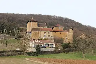 The château of Antouillet, in Panossas | |
Location of Panossas | |
 Panossas  Panossas | |
| Coordinates: 45°40′46″N 5°12′17″E / 45.6794°N 5.2047°E | |
| Country | France |
| Region | Auvergne-Rhône-Alpes |
| Department | Isère |
| Arrondissement | La Tour-du-Pin |
| Canton | Charvieu-Chavagneux |
| Government | |
| • Mayor (2024–2026) | Christophe Candy[1] |
Area 1 | 7.99 km2 (3.08 sq mi) |
| Population (2022)[2] | 682 |
| • Density | 85/km2 (220/sq mi) |
| Time zone | UTC+01:00 (CET) |
| • Summer (DST) | UTC+02:00 (CEST) |
| INSEE/Postal code | 38294 /38460 |
| Elevation | 223–390 m (732–1,280 ft) |
| 1 French Land Register data, which excludes lakes, ponds, glaciers > 1 km2 (0.386 sq mi or 247 acres) and river estuaries. | |
Panossas (French pronunciation: [panɔsa]) is a commune in the Isère department in southeastern France.[3]
Population
| Year | Pop. | ±% p.a. |
|---|---|---|
| 1968 | 166 | — |
| 1975 | 187 | +1.72% |
| 1982 | 227 | +2.81% |
| 1990 | 346 | +5.41% |
| 1999 | 498 | +4.13% |
| 2009 | 581 | +1.55% |
| 2014 | 706 | +3.97% |
| 2020 | 653 | −1.29% |
| Source: INSEE[4] | ||
See also
References
Wikimedia Commons has media related to Panossas.
- ^ "Répertoire national des élus: les maires" (in French). data.gouv.fr, Plateforme ouverte des données publiques françaises. 12 March 2025.
- ^ "Populations de référence 2022" (in French). The National Institute of Statistics and Economic Studies. 19 December 2024.
- ^ "INSEE commune file" (in French). Retrieved 19 August 2024.
- ^ Population en historique depuis 1968, INSEE