Leyrieu
Leyrieu | |
|---|---|
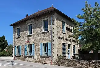 The town hall of Leyrieu | |
Location of Leyrieu | |
 Leyrieu  Leyrieu | |
| Coordinates: 45°45′25″N 5°15′18″E / 45.757°N 5.255°E | |
| Country | France |
| Region | Auvergne-Rhône-Alpes |
| Department | Isère |
| Arrondissement | La Tour-du-Pin |
| Canton | Charvieu-Chavagneux |
| Government | |
| • Mayor (2020–2026) | Jean-Yves Brenier[1] |
Area 1 | 6.39 km2 (2.47 sq mi) |
| Population (2022)[2] | 919 |
| • Density | 140/km2 (370/sq mi) |
| Time zone | UTC+01:00 (CET) |
| • Summer (DST) | UTC+02:00 (CEST) |
| INSEE/Postal code | 38210 /38460 |
| 1 French Land Register data, which excludes lakes, ponds, glaciers > 1 km2 (0.386 sq mi or 247 acres) and river estuaries. | |
Leyrieu (French pronunciation: [lɛʁjø]) is a commune in the Isère department in southeastern France.
Population
| Year | Pop. | ±% p.a. |
|---|---|---|
| 1968 | 230 | — |
| 1975 | 300 | +3.87% |
| 1982 | 376 | +3.28% |
| 1990 | 461 | +2.58% |
| 1999 | 643 | +3.77% |
| 2009 | 721 | +1.15% |
| 2014 | 790 | +1.84% |
| 2020 | 898 | +2.16% |
| Source: INSEE[3] | ||
See also
References
- ^ "Répertoire national des élus: les maires". data.gouv.fr, Plateforme ouverte des données publiques françaises (in French). 2 December 2020.
- ^ "Populations de référence 2022" (in French). The National Institute of Statistics and Economic Studies. 19 December 2024.
- ^ Population en historique depuis 1968, INSEE
Wikimedia Commons has media related to Leyrieu.