Magnas
Magnas | |
|---|---|
Location of Magnas | |
 Magnas  Magnas | |
| Coordinates: 43°53′44″N 0°43′52″E / 43.8956°N 0.7311°E | |
| Country | France |
| Region | Occitania |
| Department | Gers |
| Arrondissement | Condom |
| Canton | Fleurance-Lomagne |
| Government | |
| • Mayor (2020–2026) | Philippe de Galard[1] |
Area 1 | 3.19 km2 (1.23 sq mi) |
| Population (2022)[2] | 58 |
| • Density | 18/km2 (47/sq mi) |
| Time zone | UTC+01:00 (CET) |
| • Summer (DST) | UTC+02:00 (CEST) |
| INSEE/Postal code | 32223 /32380 |
| Elevation | 124–207 m (407–679 ft) (avg. 196 m or 643 ft) |
| 1 French Land Register data, which excludes lakes, ponds, glaciers > 1 km2 (0.386 sq mi or 247 acres) and river estuaries. | |
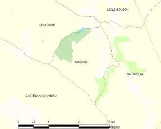
Magnas is a commune in the Gers department in southwestern France.
Geography
The river Auroue forms all of the commune's northeastern border.
Population
| Year | Pop. | ±% |
|---|---|---|
| 1962 | 77 | — |
| 1968 | 71 | −7.8% |
| 1975 | 57 | −19.7% |
| 1982 | 40 | −29.8% |
| 1990 | 61 | +52.5% |
| 1999 | 48 | −21.3% |
| 2008 | 67 | +39.6% |
See also
References
- ^ "Répertoire national des élus: les maires". data.gouv.fr, Plateforme ouverte des données publiques françaises (in French). 2 December 2020.
- ^ "Populations de référence 2022" (in French). The National Institute of Statistics and Economic Studies. 19 December 2024.
Wikimedia Commons has media related to Magnas.