Lagardère, Gers
Lagardère | |
|---|---|
 The chateau in Lagardère | |
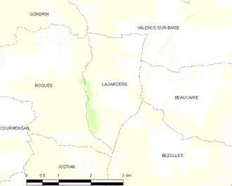
Location of Lagardère | |
 Lagardère  Lagardère | |
| Coordinates: 43°50′28″N 0°19′43″E / 43.8411°N 0.3286°E | |
| Country | France |
| Region | Occitania |
| Department | Gers |
| Arrondissement | Condom |
| Canton | Baïse-Armagnac |
| Government | |
| • Mayor (2020–2026) | Patrick Dubos[1] |
Area 1 | 4.95 km2 (1.91 sq mi) |
| Population (2022)[2] | 78 |
| • Density | 16/km2 (41/sq mi) |
| Time zone | UTC+01:00 (CET) |
| • Summer (DST) | UTC+02:00 (CEST) |
| INSEE/Postal code | 32178 /32310 |
| Elevation | 118–222 m (387–728 ft) (avg. 201 m or 659 ft) |
| 1 French Land Register data, which excludes lakes, ponds, glaciers > 1 km2 (0.386 sq mi or 247 acres) and river estuaries. | |
Lagardère (French pronunciation: [laɡaʁdɛʁ]; Occitan: La Guardèra) is a commune in the Gers department in southwestern France.
Geography
Population
| Year | Pop. | ±% |
|---|---|---|
| 1962 | 104 | — |
| 1968 | 81 | −22.1% |
| 1975 | 81 | +0.0% |
| 1982 | 75 | −7.4% |
| 1990 | 58 | −22.7% |
| 1999 | 55 | −5.2% |
| 2008 | 65 | +18.2% |
See also
References
- ^ "Répertoire national des élus: les maires". data.gouv.fr, Plateforme ouverte des données publiques françaises (in French). 2 December 2020.
- ^ "Populations de référence 2022" (in French). The National Institute of Statistics and Economic Studies. 19 December 2024.
Wikimedia Commons has media related to Lagardère (Gers).