La Loge, Pas-de-Calais
La Loge | |
|---|---|
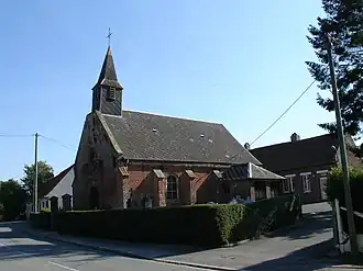 The church of La Loge | |
 Coat of arms | |
Location of La Loge | |
 La Loge  La Loge | |
| Coordinates: 50°24′28″N 2°02′03″E / 50.4078°N 2.0342°E / 50.4078; 2.0342 | |
| Country | France |
| Region | Hauts-de-France |
| Department | Pas-de-Calais |
| Arrondissement | Montreuil |
| Canton | Auxi-le-Château |
| Intercommunality | CC des 7 Vallées |
| Government | |
| • Mayor (2020–2026) | Joël Allexandre[1] |
Area 1 | 0.6 km2 (0.2 sq mi) |
| Population (2022)[2] | 218 |
| • Density | 360/km2 (940/sq mi) |
| Time zone | UTC+01:00 (CET) |
| • Summer (DST) | UTC+02:00 (CEST) |
| INSEE/Postal code | 62521 /62140 |
| Elevation | 100–116 m (328–381 ft) (avg. 108 m or 354 ft) |
| 1 French Land Register data, which excludes lakes, ponds, glaciers > 1 km2 (0.386 sq mi or 247 acres) and river estuaries. | |
La Loge (French pronunciation: [la lɔʒ]) is a commune in the Pas-de-Calais department in the Hauts-de-France region of France[3] about 12 miles (19 km) southeast of Montreuil-sur-Mer at the edge of the forest of Hesdin.
Population
| Year | Pop. | ±% p.a. |
|---|---|---|
| 1968 | 171 | — |
| 1975 | 169 | −0.17% |
| 1982 | 159 | −0.87% |
| 1990 | 181 | +1.63% |
| 1999 | 185 | +0.24% |
| 2007 | 191 | +0.40% |
| 2012 | 188 | −0.32% |
| 2017 | 201 | +1.35% |
| Source: INSEE[4] | ||
See also
References
- ^ "Répertoire national des élus: les maires". data.gouv.fr, Plateforme ouverte des données publiques françaises (in French). 2 December 2020.
- ^ "Populations de référence 2022" (in French). The National Institute of Statistics and Economic Studies. 19 December 2024.
- ^ INSEE commune file
- ^ Population en historique depuis 1968, INSEE
Wikimedia Commons has media related to La Loge.
This article is issued from Wikipedia. The text is available under Creative Commons Attribution-Share Alike 4.0 unless otherwise noted. Additional terms may apply for the media files.