Béthonsart
Béthonsart | |
|---|---|
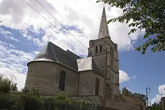 The church of Béthonsart | |
 Coat of arms | |
Location of Béthonsart | |
 Béthonsart  Béthonsart | |
| Coordinates: 50°22′36″N 2°33′04″E / 50.3767°N 2.5511°E | |
| Country | France |
| Region | Hauts-de-France |
| Department | Pas-de-Calais |
| Arrondissement | Arras |
| Canton | Avesnes-le-Comte |
| Intercommunality | CC Campagnes de l'Artois |
| Government | |
| • Mayor (2020–2026) | Jean-Marc Cuvillier[1] |
Area 1 | 4.21 km2 (1.63 sq mi) |
| Population (2022)[2] | 150 |
| • Density | 36/km2 (92/sq mi) |
| Time zone | UTC+01:00 (CET) |
| • Summer (DST) | UTC+02:00 (CEST) |
| INSEE/Postal code | 62118 /62690 |
| Elevation | 119–157 m (390–515 ft) (avg. 144 m or 472 ft) |
| 1 French Land Register data, which excludes lakes, ponds, glaciers > 1 km2 (0.386 sq mi or 247 acres) and river estuaries. | |
Béthonsart (French pronunciation: [betɔ̃saʁ]) is a commune in the Pas-de-Calais department in the Hauts-de-France region in northern France.[3]
Geography
A small farming village located 12 miles (20 km) northwest of Arras on the D74.
Population
| Year | Pop. | ±% p.a. |
|---|---|---|
| 1968 | 152 | — |
| 1975 | 127 | −2.53% |
| 1982 | 126 | −0.11% |
| 1990 | 141 | +1.42% |
| 1999 | 131 | −0.81% |
| 2009 | 167 | +2.46% |
| 2014 | 155 | −1.48% |
| 2020 | 143 | −1.33% |
| Source: INSEE[4] | ||
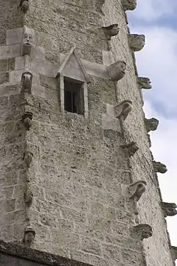
Sights
See also
References
- ^ "Répertoire national des élus: les maires". data.gouv.fr, Plateforme ouverte des données publiques françaises (in French). 9 August 2021.
- ^ "Populations de référence 2022" (in French). The National Institute of Statistics and Economic Studies. 19 December 2024.
- ^ INSEE commune file
- ^ Population en historique depuis 1968, INSEE
- ^ Base Mérimée: Eglise, Ministère français de la Culture. (in French)
Wikimedia Commons has media related to Béthonsart.