Marœuil
Marœuil
Marol | |
|---|---|
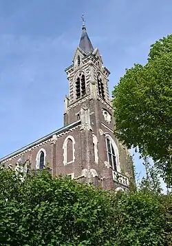 The church of Marœuil | |
 Coat of arms | |
Location of Marœuil | |
 Marœuil  Marœuil | |
| Coordinates: 50°19′29″N 2°42′23″E / 50.3247°N 2.7064°E | |
| Country | France |
| Region | Hauts-de-France |
| Department | Pas-de-Calais |
| Arrondissement | Arras |
| Canton | Arras-1 |
| Intercommunality | CU Arras |
| Government | |
| • Mayor (2020–2026) | Jean-Marie Truffier[1] |
Area 1 | 11.82 km2 (4.56 sq mi) |
| Population (2022)[2] | 2,430 |
| • Density | 210/km2 (530/sq mi) |
| Time zone | UTC+01:00 (CET) |
| • Summer (DST) | UTC+02:00 (CEST) |
| INSEE/Postal code | 62557 /62161 |
| Elevation | 58–117 m (190–384 ft) (avg. 65 m or 213 ft) |
| 1 French Land Register data, which excludes lakes, ponds, glaciers > 1 km2 (0.386 sq mi or 247 acres) and river estuaries. | |
Marœuil (French pronunciation: [maʁœj]; West Flemish: Marol) is a commune in the Pas-de-Calais department in the Hauts-de-France region of France.[3]
Geography
Marœuil is a large farming and light industrial village situated 4 miles (6 km) northwest of Arras, at the junction of the D55, D56 and the D60E roads.
Population
| Year | Pop. | ±% p.a. |
|---|---|---|
| 1968 | 1,619 | — |
| 1975 | 1,706 | +0.75% |
| 1982 | 1,815 | +0.89% |
| 1990 | 2,296 | +2.98% |
| 1999 | 2,509 | +0.99% |
| 2007 | 2,389 | −0.61% |
| 2012 | 2,452 | +0.52% |
| 2017 | 2,464 | +0.10% |
| Source: INSEE[4] | ||
Twin towns
See also
References
- ^ "Répertoire national des élus: les maires" (in French). data.gouv.fr, Plateforme ouverte des données publiques françaises. 13 September 2022.
- ^ "Populations de référence 2022" (in French). The National Institute of Statistics and Economic Studies. 19 December 2024.
- ^ INSEE commune file
- ^ Population en historique depuis 1968, INSEE
External links
Wikimedia Commons has media related to Marœuil.