Dourges
Dourges | |
|---|---|
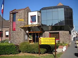 The town hall of Dourges | |
 Coat of arms | |
Location of Dourges | |
 Dourges  Dourges | |
| Coordinates: 50°26′13″N 2°59′15″E / 50.4369°N 2.9875°E / 50.4369; 2.9875 | |
| Country | France |
| Region | Hauts-de-France |
| Department | Pas-de-Calais |
| Arrondissement | Lens |
| Canton | Hénin-Beaumont-1 |
| Intercommunality | CA Hénin-Carvin |
| Government | |
| • Mayor (2020–2026) | Tony Franconville[1] |
Area 1 | 10.48 km2 (4.05 sq mi) |
| Population (2022)[2] | 6,068 |
| • Density | 580/km2 (1,500/sq mi) |
| Time zone | UTC+01:00 (CET) |
| • Summer (DST) | UTC+02:00 (CEST) |
| INSEE/Postal code | 62274 /62119 |
| Elevation | 23–35 m (75–115 ft) (avg. 29 m or 95 ft) |
| 1 French Land Register data, which excludes lakes, ponds, glaciers > 1 km2 (0.386 sq mi or 247 acres) and river estuaries. | |
Dourges (French pronunciation: [duʁʒ]) is a commune in the Pas-de-Calais department in the Hauts-de-France region of France[3] about 8 miles (13 km) east of Lens. The canalized river Deûle flows through the commune.
Population
| Year | Pop. | ±% p.a. |
|---|---|---|
| 1968 | 5,746 | — |
| 1975 | 5,402 | −0.88% |
| 1982 | 5,201 | −0.54% |
| 1990 | 5,806 | +1.39% |
| 1999 | 5,676 | −0.25% |
| 2007 | 5,637 | −0.09% |
| 2012 | 5,684 | +0.17% |
| 2017 | 5,891 | +0.72% |
| Source: INSEE[4] | ||
See also
References
- ^ "Répertoire national des élus: les maires" (in French). data.gouv.fr, Plateforme ouverte des données publiques françaises. 13 September 2022.
- ^ "Populations de référence 2022" (in French). The National Institute of Statistics and Economic Studies. 19 December 2024.
- ^ INSEE commune file
- ^ Population en historique depuis 1968, INSEE
External links
Wikimedia Commons has media related to Dourges.
- A regional website (in French)
- The CWGC cemetery
- Dourges on the Quid website (in French)
Authority control databases | |
|---|---|
| International | |
| National | |
| Geographic | |
This article is issued from Wikipedia. The text is available under Creative Commons Attribution-Share Alike 4.0 unless otherwise noted. Additional terms may apply for the media files.