Molompize
Molompize | |
|---|---|
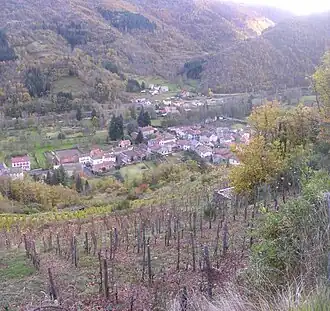 Molopize and the Alagnon valley | |
.svg.png) Coat of arms | |
Location of Molompize | |
 Molompize  Molompize | |
| Coordinates: 45°13′51″N 3°07′38″E / 45.2308°N 3.1272°E | |
| Country | France |
| Region | Auvergne-Rhône-Alpes |
| Department | Cantal |
| Arrondissement | Saint-Flour |
| Canton | Saint-Flour-1 |
| Government | |
| • Mayor (2020–2026) | Philippe Leberichel[1] |
Area 1 | 17.12 km2 (6.61 sq mi) |
| Population (2022)[2] | 272 |
| • Density | 16/km2 (41/sq mi) |
| Time zone | UTC+01:00 (CET) |
| • Summer (DST) | UTC+02:00 (CEST) |
| INSEE/Postal code | 15127 /15500 |
| Elevation | 549–997 m (1,801–3,271 ft) (avg. 588 m or 1,929 ft) |
| 1 French Land Register data, which excludes lakes, ponds, glaciers > 1 km2 (0.386 sq mi or 247 acres) and river estuaries. | |
Molompize (French pronunciation: [mɔlɔ̃piz]; Occitan: Molompise) is a commune in the Cantal department in south-central France.
Population
| Year | Pop. | ±% |
|---|---|---|
| 1962 | 448 | — |
| 1968 | 484 | +8.0% |
| 1975 | 387 | −20.0% |
| 1982 | 407 | +5.2% |
| 1990 | 341 | −16.2% |
| 1999 | 285 | −16.4% |
| 2008 | 290 | +1.8% |
| 2019 | 281 | −3.1% |
See also
References
- ^ "Répertoire national des élus: les maires" (in French). data.gouv.fr, Plateforme ouverte des données publiques françaises. 13 September 2022.
- ^ "Populations de référence 2022" (in French). The National Institute of Statistics and Economic Studies. 19 December 2024.
Wikimedia Commons has media related to Molompize.