Brageac
Brageac | |
|---|---|
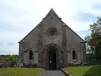 The church of Saint-Thibaud, in Brageac | |
Location of Brageac | |
 Brageac  Brageac | |
| Coordinates: 45°12′18″N 2°17′20″E / 45.205°N 2.2889°E | |
| Country | France |
| Region | Auvergne-Rhône-Alpes |
| Department | Cantal |
| Arrondissement | Mauriac |
| Canton | Mauriac |
| Intercommunality | Pays de Salers |
| Government | |
| • Mayor (2020–2026) | Régine Breuil[1] |
Area 1 | 12.23 km2 (4.72 sq mi) |
| Population (2022)[2] | 77 |
| • Density | 6.3/km2 (16/sq mi) |
| Time zone | UTC+01:00 (CET) |
| • Summer (DST) | UTC+02:00 (CEST) |
| INSEE/Postal code | 15024 /15700 |
| Elevation | 288–686 m (945–2,251 ft) (avg. 720 m or 2,360 ft) |
| 1 French Land Register data, which excludes lakes, ponds, glaciers > 1 km2 (0.386 sq mi or 247 acres) and river estuaries. | |
Brageac (French pronunciation: [bʁaʒak]; Occitan: Brajac) is a commune in the Cantal department in south-central France.
Population
| Year | Pop. | ±% |
|---|---|---|
| 1962 | 86 | — |
| 1968 | 107 | +24.4% |
| 1975 | 92 | −14.0% |
| 1982 | 80 | −13.0% |
| 1990 | 64 | −20.0% |
| 1999 | 67 | +4.7% |
| 2008 | 74 | +10.4% |
See also
References
- ^ "Répertoire national des élus: les maires". data.gouv.fr, Plateforme ouverte des données publiques françaises (in French). 9 August 2021.
- ^ "Populations de référence 2022" (in French). The National Institute of Statistics and Economic Studies. 19 December 2024.
Wikimedia Commons has media related to Brageac.