Suaux
Suaux | |
|---|---|
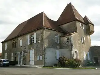 Chateau used as the town hall | |
 Coat of arms | |
Location of Suaux | |
 Suaux  Suaux | |
| Coordinates: 45°51′09″N 0°30′25″E / 45.8525°N 0.5069°E | |
| Country | France |
| Region | Nouvelle-Aquitaine |
| Department | Charente |
| Arrondissement | Confolens |
| Canton | Charente-Bonnieure |
| Government | |
| • Mayor (2020–2026) | Olivier Périnet[1] |
Area 1 | 11.93 km2 (4.61 sq mi) |
| Population (2022)[2] | 380 |
| • Density | 32/km2 (82/sq mi) |
| Time zone | UTC+01:00 (CET) |
| • Summer (DST) | UTC+02:00 (CEST) |
| INSEE/Postal code | 16375 /16260 |
| Elevation | 120–212 m (394–696 ft) (avg. 184 m or 604 ft) |
| 1 French Land Register data, which excludes lakes, ponds, glaciers > 1 km2 (0.386 sq mi or 247 acres) and river estuaries. | |
Suaux (French pronunciation: [sɥo]) is a commune in the Charente department in southwestern France.
Population
| Year | Pop. | ±% p.a. |
|---|---|---|
| 1968 | 484 | — |
| 1975 | 460 | −0.72% |
| 1982 | 373 | −2.95% |
| 1990 | 367 | −0.20% |
| 1999 | 356 | −0.34% |
| 2009 | 382 | +0.71% |
| 2014 | 430 | +2.40% |
| 2020 | 384 | −1.87% |
| Source: INSEE[3] | ||
See also
References
- ^ "Répertoire national des élus: les maires". data.gouv.fr, Plateforme ouverte des données publiques françaises (in French). 2 December 2020.
- ^ "Populations de référence 2022" (in French). The National Institute of Statistics and Economic Studies. 19 December 2024.
- ^ Population en historique depuis 1968, INSEE
Wikimedia Commons has media related to Suaux.