Fleurac, Charente
Fleurac | |
|---|---|
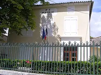 Town hall | |
Location of Fleurac | |
 Fleurac  Fleurac | |
| Coordinates: 45°43′18″N 0°04′56″W / 45.7217°N 0.0822°W | |
| Country | France |
| Region | Nouvelle-Aquitaine |
| Department | Charente |
| Arrondissement | Cognac |
| Canton | Jarnac |
| Intercommunality | CA Grand Cognac |
| Government | |
| • Mayor (2020–2026) | Michel Ecalle[1] |
Area 1 | 2.17 km2 (0.84 sq mi) |
| Population (2022)[2] | 220 |
| • Density | 100/km2 (260/sq mi) |
| Time zone | UTC+01:00 (CET) |
| • Summer (DST) | UTC+02:00 (CEST) |
| INSEE/Postal code | 16139 /16200 |
| Elevation | 49–92 m (161–302 ft) (avg. 64 m or 210 ft) |
| 1 French Land Register data, which excludes lakes, ponds, glaciers > 1 km2 (0.386 sq mi or 247 acres) and river estuaries. | |
Fleurac (French pronunciation: [flœʁak]) is a commune in the Charente department in southwestern France.
Population
| Year | Pop. | ±% p.a. |
|---|---|---|
| 1968 | 251 | — |
| 1975 | 257 | +0.34% |
| 1982 | 238 | −1.09% |
| 1990 | 244 | +0.31% |
| 1999 | 232 | −0.56% |
| 2009 | 237 | +0.21% |
| 2014 | 250 | +1.07% |
| 2020 | 239 | −0.75% |
| Source: INSEE[3] | ||
See also
References
- ^ "Répertoire national des élus: les maires". data.gouv.fr, Plateforme ouverte des données publiques françaises (in French). 9 August 2021.
- ^ "Populations de référence 2022" (in French). The National Institute of Statistics and Economic Studies. 19 December 2024.
- ^ Population en historique depuis 1968, INSEE
Wikimedia Commons has media related to Fleurac (Charente).