Spycker
Spycker | |
|---|---|
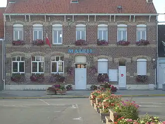 Town hall in Spycker | |
.svg.png) Coat of arms | |
Location of Spycker | |
 Spycker  Spycker | |
| Coordinates: 50°58′12″N 2°19′27″E / 50.97°N 2.3242°E | |
| Country | France |
| Region | Hauts-de-France |
| Department | Nord |
| Arrondissement | Dunkerque |
| Canton | Coudekerque-Branche |
| Intercommunality | CU Dunkerque |
| Government | |
| • Mayor (2020–2026) | Jean-Luc Goetbloet[1] |
Area 1 | 9.19 km2 (3.55 sq mi) |
| Population (2022)[2] | 1,725 |
| • Density | 190/km2 (490/sq mi) |
| Time zone | UTC+01:00 (CET) |
| • Summer (DST) | UTC+02:00 (CEST) |
| INSEE/Postal code | 59576 /59380 |
| Elevation | 0–5 m (0–16 ft) (avg. 10 m or 33 ft) |
| 1 French Land Register data, which excludes lakes, ponds, glaciers > 1 km2 (0.386 sq mi or 247 acres) and river estuaries. | |
Spycker (French: [spikɛʁ]; Dutch: Spijker [ˈspɛikər]; West Flemish: Spyker) is a commune in the Nord department in northern France.[3]
History
Spycker was liberated by soldiers of The Black Watch (Royal Highland Regiment) of Canada in September 1944.[4]
Heraldry
_Nord-France.svg.png) |
The arms of Spycker are blazoned : Argent billetty, a lion sable armed and langued gules. (Loon-Plage and use the same arms.)
|
See also
References
- ^ "Répertoire national des élus: les maires". data.gouv.fr, Plateforme ouverte des données publiques françaises (in French). 2 December 2020.
- ^ "Populations de référence 2022" (in French). The National Institute of Statistics and Economic Studies. 19 December 2024.
- ^ INSEE commune file
- ^ O'Keefe, David R. "With Blinders On: The Black Watch and the Battle for Spycker, September 12–14, 1944." Canadian Army Journal, Volume 11, No. 1 Spring 2008.
Wikimedia Commons has media related to Spycker.