Flers-en-Escrebieux
Flers-en-Escrebieux | |
|---|---|
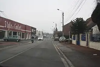 A view within Flers-en-Escrebieux | |
_Nord-France.svg.png) Coat of arms | |
Location of Flers-en-Escrebieux | |
 Flers-en-Escrebieux  Flers-en-Escrebieux | |
| Coordinates: 50°23′53″N 3°03′47″E / 50.398°N 3.063°E | |
| Country | France |
| Region | Hauts-de-France |
| Department | Nord |
| Arrondissement | Douai |
| Canton | Douai |
| Intercommunality | Douaisis Agglo |
| Government | |
| • Mayor (2020–2026) | Jean-Jacques Peyraud[1] |
Area 1 | 7.11 km2 (2.75 sq mi) |
| Population (2022)[2] | 5,533 |
| • Density | 780/km2 (2,000/sq mi) |
| Time zone | UTC+01:00 (CET) |
| • Summer (DST) | UTC+02:00 (CEST) |
| INSEE/Postal code | 59234 /59128 |
| Elevation | 18–43 m (59–141 ft) (avg. 23 m or 75 ft) |
| 1 French Land Register data, which excludes lakes, ponds, glaciers > 1 km2 (0.386 sq mi or 247 acres) and river estuaries. | |
Flers-en-Escrebieux (French pronunciation: [flɛʁs ɑ̃.n‿ɛskʁəbjø]) is a commune in the Nord department in northern France.[3]
Population
| Year | Pop. | ±% p.a. |
|---|---|---|
| 1968 | 6,675 | — |
| 1975 | 6,431 | −0.53% |
| 1982 | 5,491 | −2.23% |
| 1990 | 5,344 | −0.34% |
| 1999 | 5,540 | +0.40% |
| 2007 | 5,342 | −0.45% |
| 2012 | 5,769 | +1.55% |
| 2017 | 5,856 | +0.30% |
| Source: INSEE[4] | ||
Heraldry
|
The arms of Flers-en-Escrebieux are blazoned : Argent, a chevron, and in base an annulet gules.
|
See also
References
- ^ "Répertoire national des élus: les maires". data.gouv.fr, Plateforme ouverte des données publiques françaises (in French). 2 December 2020.
- ^ "Populations de référence 2022" (in French). The National Institute of Statistics and Economic Studies. 19 December 2024.
- ^ INSEE commune file
- ^ Population en historique depuis 1968, INSEE
Wikimedia Commons has media related to Flers-en-Escrebieux.