Bruille-Saint-Amand
Bruille-Saint-Amand | |
|---|---|
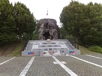 The ruins of the mill, and memorial | |
_Nord-france.svg.png) Coat of arms | |
Location of Bruille-Saint-Amand | |
 Bruille-Saint-Amand  Bruille-Saint-Amand | |
| Coordinates: 50°28′24″N 3°30′03″E / 50.4733°N 3.5008°E | |
| Country | France |
| Region | Hauts-de-France |
| Department | Nord |
| Arrondissement | Valenciennes |
| Canton | Saint-Amand-les-Eaux |
| Intercommunality | CA Porte du Hainaut |
| Government | |
| • Mayor (2020–2026) | Christophe Pannier[1] |
Area 1 | 7.88 km2 (3.04 sq mi) |
| Population (2022)[2] | 1,693 |
| • Density | 210/km2 (560/sq mi) |
| Time zone | UTC+01:00 (CET) |
| • Summer (DST) | UTC+02:00 (CEST) |
| INSEE/Postal code | 59114 /59199 |
| Elevation | 16–38 m (52–125 ft) (avg. 40 m or 130 ft) |
| 1 French Land Register data, which excludes lakes, ponds, glaciers > 1 km2 (0.386 sq mi or 247 acres) and river estuaries. | |
Bruille-Saint-Amand (French pronunciation: [bʁɥij sɛ̃.t‿amɑ̃]) is a commune in the Nord department in northern France.[3]
Population
| Year | Pop. | ±% p.a. |
|---|---|---|
| 1968 | 1,442 | — |
| 1975 | 1,381 | −0.62% |
| 1982 | 1,391 | +0.10% |
| 1990 | 1,473 | +0.72% |
| 1999 | 1,470 | −0.02% |
| 2009 | 1,575 | +0.69% |
| 2014 | 1,652 | +0.96% |
| 2020 | 1,671 | +0.19% |
| Source: INSEE[4] | ||
Photos


Heraldry
|
The arms of Bruille-Saint-Amand are blazoned : Or, a cross gules. (, Flines-lès-Mortagne, Mortagne-du-Nord and Nivelle use the same arms.)
|
See also
References
- ^ "Répertoire national des élus: les maires". data.gouv.fr, Plateforme ouverte des données publiques françaises (in French). 2 December 2020.
- ^ "Populations de référence 2022" (in French). The National Institute of Statistics and Economic Studies. 19 December 2024.
- ^ INSEE commune file
- ^ Population en historique depuis 1968, INSEE
Wikimedia Commons has media related to Bruille-Saint-Amand.