Saint-Martin-d'Écublei
Saint-Martin-d'Écublei | |
|---|---|
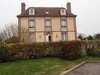 The town hall in Saint-Martin-d'Écublei | |
Location of Saint-Martin-d'Écublei | |
 Saint-Martin-d'Écublei  Saint-Martin-d'Écublei | |
| Coordinates: 48°47′29″N 0°40′44″E / 48.7914°N 0.6789°E | |
| Country | France |
| Region | Normandy |
| Department | Orne |
| Arrondissement | Mortagne-au-Perche |
| Canton | L'Aigle |
| Intercommunality | Pays de l'Aigle |
| Government | |
| • Mayor (2020–2026) | Franck Gaultier[1] |
Area 1 | 11.94 km2 (4.61 sq mi) |
| Population (2022)[2] | 630 |
| • Density | 53/km2 (140/sq mi) |
| Time zone | UTC+01:00 (CET) |
| • Summer (DST) | UTC+02:00 (CEST) |
| INSEE/Postal code | 61423 /61300 |
| Elevation | 182–248 m (597–814 ft) (avg. 210 m or 690 ft) |
| 1 French Land Register data, which excludes lakes, ponds, glaciers > 1 km2 (0.386 sq mi or 247 acres) and river estuaries. | |
Saint-Martin-d'Écublei (French pronunciation: [sɛ̃ maʁtɛ̃ dekyblɛ] ⓘ) is a commune in the Orne department in north-western France.[3]
The town of Saint-Martin d'Ecublei borders the department of Eure. It covers 1,195 hectares (4.61 sq mi), is 11 kilometres (7 mi) long, and has a width of 3 km (1.9 mi) at the farthest points.[4]

See also
References
- ^ "Répertoire national des élus: les maires". data.gouv.fr, Plateforme ouverte des données publiques françaises (in French). 9 August 2021.
- ^ "Populations de référence 2022" (in French). The National Institute of Statistics and Economic Studies. 19 December 2024.
- ^ INSEE commune file
- ^ wikipedia"
Wikimedia Commons has media related to Saint-Martin-d'Écublei.