Coulmer
Coulmer | |
|---|---|
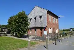
.jpg) The church in Coulmer | |
Location of Coulmer | |
 Coulmer  Coulmer | |
| Coordinates: 48°46′32″N 0°17′52″E / 48.7756°N 0.2978°E | |
| Country | France |
| Region | Normandy |
| Department | Orne |
| Arrondissement | Mortagne-au-Perche |
| Canton | Vimoutiers |
| Intercommunality | Vallées d'Auge et du Merlerault |
| Government | |
| • Mayor (2020–2026) | Chantal Nicoleau[1] |
Area 1 | 6.68 km2 (2.58 sq mi) |
| Population (2022)[2] | 81 |
| • Density | 12/km2 (31/sq mi) |
| Time zone | UTC+01:00 (CET) |
| • Summer (DST) | UTC+02:00 (CEST) |
| INSEE/Postal code | 61122 /61230 |
| Elevation | 189–300 m (620–984 ft) (avg. 192 m or 630 ft) |
| 1 French Land Register data, which excludes lakes, ponds, glaciers > 1 km2 (0.386 sq mi or 247 acres) and river estuaries. | |
Coulmer is a commune in the Orne department in north-western France.
Geography
The commune is made up of the following collection of villages and hamlets, Le Chêne, Le Pommeret, La Faudinière, Les Portes and Coulmer.[3]
The Commune is one of 27 communes that make up the Natura 2000 protected area of Bocages et vergers du sud Pays d'Auge.[4]
The commune has two rivers flowing through its borders, The Touques and the Maure. In addition it has 5 streams running through it, La Noe, the Bouillant, the Bouillonnay, the Launay and the Menil.
Neighbouring communes[3] | |
|---|---|
.jpg)
See also
References
- ^ "Répertoire national des élus: les maires". data.gouv.fr, Plateforme ouverte des données publiques françaises (in French). 9 August 2021.
- ^ "Populations de référence 2022" (in French). The National Institute of Statistics and Economic Studies. 19 December 2024.
- ^ a b "Coulmer · 61230, France". Coulmer · 61230, France.
- ^ "INPN - FSD Natura 2000 - FR2502014 - Bocages et vergers du sud Pays d'Auge - Description".
Wikimedia Commons has media related to Coulmer.