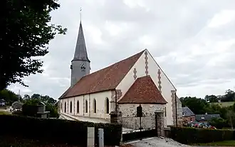
Chaumont, Orne
Chaumont | |
|---|---|
 | |
Location of Chaumont | |
 Chaumont  Chaumont | |
| Coordinates: 48°50′09″N 0°19′32″E / 48.8358°N 0.3256°E | |
| Country | France |
| Region | Normandy |
| Department | Orne |
| Arrondissement | Mortagne-au-Perche |
| Canton | Vimoutiers |
| Intercommunality | Vallées d'Auge et du Merlerault |
| Government | |
| • Mayor (2020–2026) | Thérèse Colette[1] |
Area 1 | 19.51 km2 (7.53 sq mi) |
| Population (2022)[2] | 167 |
| • Density | 8.6/km2 (22/sq mi) |
| Time zone | UTC+01:00 (CET) |
| • Summer (DST) | UTC+02:00 (CEST) |
| INSEE/Postal code | 61103 /61230 |
| Elevation | 189–304 m (620–997 ft) (avg. 300 m or 980 ft) |
| 1 French Land Register data, which excludes lakes, ponds, glaciers > 1 km2 (0.386 sq mi or 247 acres) and river estuaries. | |
Chaumont (French pronunciation: [ʃomɔ̃] ⓘ) is a commune in the Orne department in north-western France.
Geography
The commune along with another 69 communes shares part of a 4,747 hectare, Natura 2000 conservation area, called Risle, Guiel, Charentonne.[3]
See also
References
- ^ "Répertoire national des élus: les maires". data.gouv.fr, Plateforme ouverte des données publiques françaises (in French). 9 August 2021.
- ^ "Populations de référence 2022" (in French). The National Institute of Statistics and Economic Studies. 19 December 2024.
- ^ "INPN - FSD Natura 2000 - FR2300150 - Risle, Guiel, Charentonne - Description".
Wikimedia Commons has media related to Chaumont (Orne).