Mons, Charente-Maritime
Mons | |
|---|---|
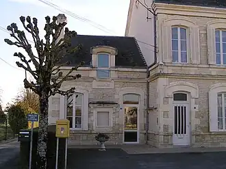 Town hall | |
Location of Mons | |
 Mons  Mons | |
| Coordinates: 45°49′18″N 0°20′39″W / 45.8217°N 0.3442°W | |
| Country | France |
| Region | Nouvelle-Aquitaine |
| Department | Charente-Maritime |
| Arrondissement | Saint-Jean-d'Angély |
| Canton | Matha |
| Government | |
| • Mayor (2020–2026) | Jean-Michel Manceau[1] |
Area 1 | 15.63 km2 (6.03 sq mi) |
| Population (2022)[2] | 446 |
| • Density | 29/km2 (74/sq mi) |
| Time zone | UTC+01:00 (CET) |
| • Summer (DST) | UTC+02:00 (CEST) |
| INSEE/Postal code | 17239 /17160 |
| Elevation | 14–31 m (46–102 ft) (avg. 24 m or 79 ft) |
| 1 French Land Register data, which excludes lakes, ponds, glaciers > 1 km2 (0.386 sq mi or 247 acres) and river estuaries. | |
Mons (French pronunciation: [mɔ̃s] ⓘ) is a commune in the Charente-Maritime department in southwestern France.
Population
| Year | Pop. | ±% |
|---|---|---|
| 1962 | 534 | — |
| 1968 | 530 | −0.7% |
| 1975 | 509 | −4.0% |
| 1982 | 488 | −4.1% |
| 1990 | 439 | −10.0% |
| 1999 | 448 | +2.1% |
| 2008 | 458 | +2.2% |
See also
References
- ^ "Répertoire national des élus: les maires". data.gouv.fr, Plateforme ouverte des données publiques françaises (in French). 9 August 2021.
- ^ "Populations de référence 2022" (in French). The National Institute of Statistics and Economic Studies. 19 December 2024.
External links
 Media related to Mons (Charente-Maritime) at Wikimedia Commons