Cabariot
Cabariot | |
|---|---|
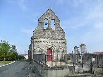 The church in Cabariot | |
Location of Cabariot | |
 Cabariot  Cabariot | |
| Coordinates: 45°55′36″N 0°51′21″W / 45.9267°N 0.8558°W | |
| Country | France |
| Region | Nouvelle-Aquitaine |
| Department | Charente-Maritime |
| Arrondissement | Rochefort |
| Canton | Tonnay-Charente |
| Intercommunality | CA Rochefort Océan |
| Government | |
| • Mayor (2020–2026) | Christian Branger[1] |
Area 1 | 15.12 km2 (5.84 sq mi) |
| Population (2022)[2] | 1,470 |
| • Density | 97/km2 (250/sq mi) |
| Time zone | UTC+01:00 (CET) |
| • Summer (DST) | UTC+02:00 (CEST) |
| INSEE/Postal code | 17075 /17430 |
| Elevation | 1–27 m (3.3–88.6 ft) |
| 1 French Land Register data, which excludes lakes, ponds, glaciers > 1 km2 (0.386 sq mi or 247 acres) and river estuaries. | |
Cabariot (French pronunciation: [kabaʁjo]) is a commune in the Charente-Maritime department in southwestern France.
Geography
The river Boutonne forms part of the commune's southeastern border, then flows into the Charente, which forms all of its southwestern border.
Population
| Year | Pop. | ±% p.a. |
|---|---|---|
| 1968 | 881 | — |
| 1975 | 921 | +0.64% |
| 1982 | 894 | −0.42% |
| 1990 | 1,087 | +2.47% |
| 1999 | 1,080 | −0.07% |
| 2007 | 1,193 | +1.25% |
| 2012 | 1,328 | +2.17% |
| 2017 | 1,341 | +0.20% |
| Source: INSEE[3] | ||
See also
References
- ^ "Répertoire national des élus: les maires" (in French). data.gouv.fr, Plateforme ouverte des données publiques françaises. 13 September 2022.
- ^ "Populations de référence 2022" (in French). The National Institute of Statistics and Economic Studies. 19 December 2024.
- ^ Population en historique depuis 1968, INSEE
External links
 Media related to Cabariot at Wikimedia Commons