Godisson
Godisson | |
|---|---|
Part of Merlerault-le-Pin | |
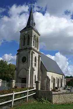 Saint George's church, Godisson | |
Location of Godisson | |
 Godisson  Godisson | |
| Coordinates: 48°40′49″N 0°15′08″E / 48.6803°N 0.2522°E | |
| Country | France |
| Region | Normandy |
| Department | Orne |
| Arrondissement | Mortagne-au-Perche |
| Canton | Rai |
| Commune | Merlerault-le-Pin |
Area 1 | 6.21 km2 (2.40 sq mi) |
| Population (2022)[1] | 103 |
| • Density | 17/km2 (43/sq mi) |
| Time zone | UTC+01:00 (CET) |
| • Summer (DST) | UTC+02:00 (CEST) |
| Postal code | 61240 |
| Elevation | 175–267 m (574–876 ft) (avg. 221 m or 725 ft) |
| 1 French Land Register data, which excludes lakes, ponds, glaciers > 1 km2 (0.386 sq mi or 247 acres) and river estuaries. | |
Godisson (French pronunciation: [ɡɔdisɔ̃] ⓘ) is a former commune in the Orne department in north-western France. On 1 January 2025, it was merged into the new commune of Merlerault-le-Pin.[2]
Geography
The former commune is part of a 20,593 hectare, Natura 2000 conservation area, called the Haute vallée de l'Orne et affluents.[3]
See also
References
- ^ "Populations de référence 2022" [Reference populations 2022] (PDF) (in French). INSEE. December 2024.
- ^ Arrêté du 13 septembre 2024 portant création de la commune nouvelle de Merlerault-le-Pin, Légifrance, retrieved 16 January 2025
- ^ "INPN - FSD Natura 2000 - FR2500099 - Haute vallée de l'Orne et affluents - Description".
Wikimedia Commons has media related to Godisson.