Sorio
Sorio | |
|---|---|
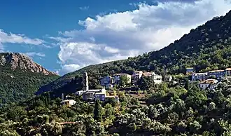 The church and surrounding buildings in Sorio | |
Location of Sorio | |
 Sorio 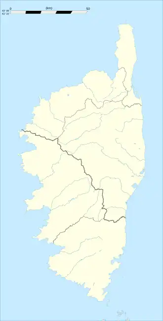 Sorio | |
| Coordinates: 42°35′02″N 9°16′28″E / 42.5839°N 9.2744°E | |
| Country | France |
| Region | Corsica |
| Department | Haute-Corse |
| Arrondissement | Calvi |
| Canton | Biguglia-Nebbio |
| Government | |
| • Mayor (2020–2026) | Joseph Chiarelli[1] |
Area 1 | 15.56 km2 (6.01 sq mi) |
| Population (2022)[2] | 129 |
| • Density | 8.3/km2 (21/sq mi) |
| Time zone | UTC+01:00 (CET) |
| • Summer (DST) | UTC+02:00 (CEST) |
| INSEE/Postal code | 2B287 /20246 |
| Elevation | 119–1,535 m (390–5,036 ft) (avg. 400 m or 1,300 ft) |
| 1 French Land Register data, which excludes lakes, ponds, glaciers > 1 km2 (0.386 sq mi or 247 acres) and river estuaries. | |
Sorio (French pronunciation: [sɔʁjo]; Corsican: Soriu) is a commune in the Haute-Corse department of France on the island of Corsica.
Population
| Year | Pop. | ±% |
|---|---|---|
| 1962 | 154 | — |
| 1968 | 165 | +7.1% |
| 1975 | 141 | −14.5% |
| 1982 | 118 | −16.3% |
| 1990 | 126 | +6.8% |
| 1999 | 148 | +17.5% |
| 2008 | 154 | +4.1% |
See also
References
- ^ "Répertoire national des élus: les maires". data.gouv.fr, Plateforme ouverte des données publiques françaises (in French). 2 December 2020.
- ^ "Populations de référence 2022" (in French). The National Institute of Statistics and Economic Studies. 19 December 2024.
Wikimedia Commons has media related to Sorio.