Omessa
Omessa | |
|---|---|
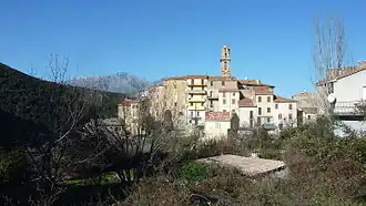 The village of Omessa | |
Location of Omessa | |
 Omessa 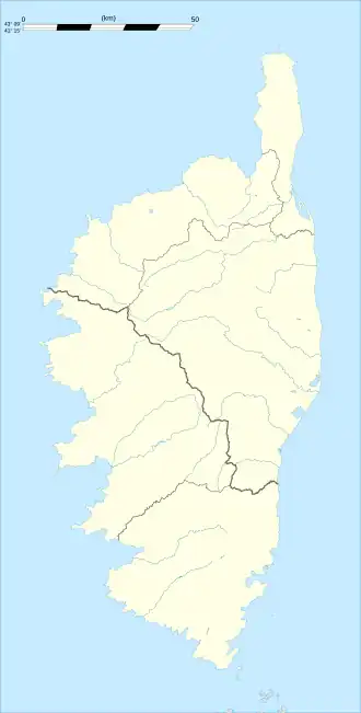 Omessa | |
| Coordinates: 42°22′16″N 9°12′39″E / 42.3711°N 9.2108°E | |
| Country | France |
| Region | Corsica |
| Department | Haute-Corse |
| Arrondissement | Corte |
| Canton | Golo-Morosaglia |
| Government | |
| • Mayor (2020–2026) | Jean-François Filippi[1] |
Area 1 | 24.4 km2 (9.4 sq mi) |
| Population (2022)[2] | 599 |
| • Density | 25/km2 (64/sq mi) |
| Time zone | UTC+01:00 (CET) |
| • Summer (DST) | UTC+02:00 (CEST) |
| INSEE/Postal code | 2B193 /20236 |
| Elevation | 239–1,335 m (784–4,380 ft) (avg. 450 m or 1,480 ft) |
| 1 French Land Register data, which excludes lakes, ponds, glaciers > 1 km2 (0.386 sq mi or 247 acres) and river estuaries. | |
Omessa (French pronunciation: [ɔmɛsa]) is a commune in the Haute-Corse department of France on the island of Corsica.
Population
| Year | Pop. | ±% |
|---|---|---|
| 1962 | 578 | — |
| 1968 | 634 | +9.7% |
| 1975 | 634 | +0.0% |
| 1982 | 509 | −19.7% |
| 1990 | 517 | +1.6% |
| 1999 | 537 | +3.9% |
| 2008 | 590 | +9.9% |
Transport
The town is served by a station on the Corsican Railways.
See also
References
- ^ "Répertoire national des élus: les maires". data.gouv.fr, Plateforme ouverte des données publiques françaises (in French). 2 December 2020.
- ^ "Populations de référence 2022" (in French). The National Institute of Statistics and Economic Studies. 19 December 2024.
Wikimedia Commons has media related to Omessa.