Épinac
Épinac | |
|---|---|
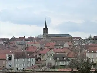 Church and town centre | |
.svg.png) Coat of arms | |
Location of Épinac | |
 Épinac 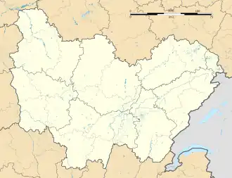 Épinac | |
| Coordinates: 46°59′32″N 4°30′52″E / 46.9922°N 4.5144°E | |
| Country | France |
| Region | Bourgogne-Franche-Comté |
| Department | Saône-et-Loire |
| Arrondissement | Autun |
| Canton | Autun-1 |
Area 1 | 25.77 km2 (9.95 sq mi) |
| Population (2022)[1] | 2,150 |
| • Density | 83/km2 (220/sq mi) |
| Time zone | UTC+01:00 (CET) |
| • Summer (DST) | UTC+02:00 (CEST) |
| INSEE/Postal code | 71190 /71360 |
| Elevation | 314–475 m (1,030–1,558 ft) (avg. 343 m or 1,125 ft) |
| 1 French Land Register data, which excludes lakes, ponds, glaciers > 1 km2 (0.386 sq mi or 247 acres) and river estuaries. | |
Épinac (French pronunciation: [epinak]) is a commune in the Saône-et-Loire department located in the region of Bourgogne-Franche-Comté in eastern France.
Population
| Year | Pop. | ±% p.a. |
|---|---|---|
| 1968 | 3,120 | — |
| 1975 | 2,891 | −1.08% |
| 1982 | 2,636 | −1.31% |
| 1990 | 2,569 | −0.32% |
| 1999 | 2,522 | −0.20% |
| 2007 | 2,398 | −0.63% |
| 2012 | 2,320 | −0.66% |
| 2017 | 2,217 | −0.90% |
| Source: INSEE[2] | ||
See also
References
- ^ "Populations de référence 2022" (in French). The National Institute of Statistics and Economic Studies. 19 December 2024.
- ^ Population en historique depuis 1968, INSEE
Wikimedia Commons has media related to Épinac.