Marcilly-lès-Buxy
Marcilly-lès-Buxy | |
|---|---|
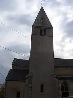 The church in Marcilly-lès-Buxy | |
.svg.png) Coat of arms | |
Location of Marcilly-lès-Buxy | |
 Marcilly-lès-Buxy 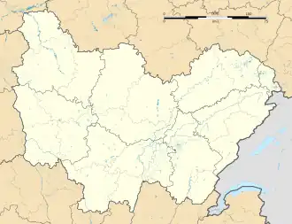 Marcilly-lès-Buxy | |
| Coordinates: 46°43′08″N 4°35′47″E / 46.7189°N 4.5964°E | |
| Country | France |
| Region | Bourgogne-Franche-Comté |
| Department | Saône-et-Loire |
| Arrondissement | Chalon-sur-Saône |
| Canton | Givry |
| Intercommunality | Sud Côte Chalonnaise |
| Government | |
| • Mayor (2020–2026) | Florent Marillier[1] |
Area 1 | 18.98 km2 (7.33 sq mi) |
| Population (2022)[2] | 683 |
| • Density | 36/km2 (93/sq mi) |
| Time zone | UTC+01:00 (CET) |
| • Summer (DST) | UTC+02:00 (CEST) |
| INSEE/Postal code | 71277 /71390 |
| Elevation | 264–476 m (866–1,562 ft) (avg. 371 m or 1,217 ft) |
| 1 French Land Register data, which excludes lakes, ponds, glaciers > 1 km2 (0.386 sq mi or 247 acres) and river estuaries. | |
Marcilly-lès-Buxy is a commune in the Saône-et-Loire department in the region of Bourgogne-Franche-Comté in eastern France.
See also
References
- ^ "Répertoire national des élus: les maires" (in French). data.gouv.fr, Plateforme ouverte des données publiques françaises. 13 September 2022.
- ^ "Populations de référence 2022" (in French). The National Institute of Statistics and Economic Studies. 19 December 2024.
Wikimedia Commons has media related to Marcilly-lès-Buxy.