Crac'h
Crac'h
Krac'h | |
|---|---|
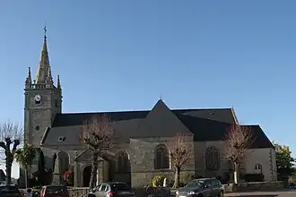 The church of Saint-Thuriau, in Crac'h | |
.svg.png) Coat of arms | |
Location of Crac'h | |
 Crac'h  Crac'h | |
| Coordinates: 47°37′05″N 3°00′01″W / 47.6181°N 3.0003°W | |
| Country | France |
| Region | Brittany |
| Department | Morbihan |
| Arrondissement | Lorient |
| Canton | Auray |
| Intercommunality | Auray Quiberon Terre Atlantique |
| Government | |
| • Mayor (2020–2026) | Jean-Loïc Bonnemains[1] |
Area 1 | 30.54 km2 (11.79 sq mi) |
| Population (2022)[2] | 3,458 |
| • Density | 110/km2 (290/sq mi) |
| Time zone | UTC+01:00 (CET) |
| • Summer (DST) | UTC+02:00 (CEST) |
| INSEE/Postal code | 56046 /56950 |
| Elevation | 0–44 m (0–144 ft) |
| 1 French Land Register data, which excludes lakes, ponds, glaciers > 1 km2 (0.386 sq mi or 247 acres) and river estuaries. | |
Crac'h (official French name: Crach, French pronunciation: [kʁak]) or Krac'h in Breton (Breton pronunciation: [krax]) is a commune in the Morbihan department of Brittany in north-western France.[3]
Population
| Year | Pop. | ±% p.a. |
|---|---|---|
| 1968 | 1,928 | — |
| 1975 | 2,001 | +0.53% |
| 1982 | 2,535 | +3.44% |
| 1990 | 2,762 | +1.08% |
| 1999 | 3,030 | +1.03% |
| 2007 | 3,260 | +0.92% |
| 2012 | 3,285 | +0.15% |
| 2017 | 3,339 | +0.33% |
| Source: INSEE[4] | ||
Inhabitants of Crac'h are called in French Crachois and in Breton Krac'hiz.
See also
References
- ^ "Maires du Morbihan" (PDF). Préfecture du Morbihan. 7 July 2020.
- ^ "Populations de référence 2022" (in French). The National Institute of Statistics and Economic Studies. 19 December 2024.
- ^ INSEE commune file
- ^ Population en historique depuis 1968, INSEE
External links
Wikimedia Commons has media related to Crach.
- Official site (in French)
- Base Mérimée: Search for heritage in the commune, Ministère français de la Culture. (in French)
- Mayors of Morbihan Association (in French)