Théhillac
Théhillac
Tehelieg | |
|---|---|
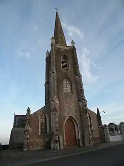 The church in Théhillac | |
.svg.png) Coat of arms | |
Location of Théhillac | |
 Théhillac  Théhillac | |
| Coordinates: 47°34′07″N 2°06′55″W / 47.5686°N 2.1153°W | |
| Country | France |
| Region | Brittany |
| Department | Morbihan |
| Arrondissement | Vannes |
| Canton | Guer |
| Intercommunality | Redon Agglomération |
| Government | |
| • Mayor (2020–2026) | Christian Lemée[1] |
Area 1 | 14.46 km2 (5.58 sq mi) |
| Population (2022)[2] | 610 |
| • Density | 42/km2 (110/sq mi) |
| Time zone | UTC+01:00 (CET) |
| • Summer (DST) | UTC+02:00 (CEST) |
| INSEE/Postal code | 56250 /56130 |
| Elevation | 1–62 m (3.3–203.4 ft) |
| 1 French Land Register data, which excludes lakes, ponds, glaciers > 1 km2 (0.386 sq mi or 247 acres) and river estuaries. | |
Théhillac (French pronunciation: [te.ijak] ⓘ; Breton: Tehelieg) is a commune in the Morbihan department of Brittany in north-western France.[3]
Demographics
Inhabitants of Théhillac are called in French Théhillacois. The population was 596 as of 2017, an increase of 16% compared with 1999.[4]
See also
References
- ^ "Répertoire national des élus: les maires" (in French). data.gouv.fr, Plateforme ouverte des données publiques françaises. 13 September 2022.
- ^ "Populations de référence 2022" (in French). The National Institute of Statistics and Economic Studies. 19 December 2024.
- ^ INSEE commune file
- ^ Population en historique depuis 1968, INSEE
External links
Wikimedia Commons has media related to Théhillac.
- Official website (in French)
- Base Mérimée: Search for heritage in the commune, Ministère français de la Culture. (in French)
- Mayors of Morbihan Association (in French)