Inguiniel
Inguiniel
An Ignel | |
|---|---|
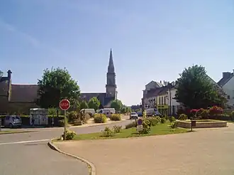 A view within Inguiniel | |
Location of Inguiniel | |
 Inguiniel  Inguiniel | |
| Coordinates: 47°58′37″N 3°16′54″W / 47.9769°N 3.2817°W | |
| Country | France |
| Region | Brittany |
| Department | Morbihan |
| Arrondissement | Lorient |
| Canton | Guidel |
| Intercommunality | Lorient Agglomération |
| Government | |
| • Mayor (2020–2026) | Jean-Louis Le Masle[1] |
Area 1 | 51.40 km2 (19.85 sq mi) |
| Population (2022)[2] | 2,196 |
| • Density | 43/km2 (110/sq mi) |
| Time zone | UTC+01:00 (CET) |
| • Summer (DST) | UTC+02:00 (CEST) |
| INSEE/Postal code | 56089 /56240 |
| Elevation | 49–171 m (161–561 ft) |
| 1 French Land Register data, which excludes lakes, ponds, glaciers > 1 km2 (0.386 sq mi or 247 acres) and river estuaries. | |
Inguiniel (French pronunciation: [ɛ̃ɡinjɛl]; Breton: An Ignel) is a commune in the Morbihan department in Brittany in north-western France.[3]
Population
| Year | Pop. | ±% p.a. |
|---|---|---|
| 1968 | 2,309 | — |
| 1975 | 2,115 | −1.25% |
| 1982 | 2,030 | −0.58% |
| 1990 | 1,968 | −0.39% |
| 1999 | 1,890 | −0.45% |
| 2007 | 2,043 | +0.98% |
| 2012 | 2,069 | +0.25% |
| 2017 | 2,158 | +0.85% |
| Source: INSEE[4] | ||
Inhabitants of Inguiniel are called in French Inguinielois.
See also
References
- ^ "Maires du Morbihan" (PDF). Préfecture du Morbihan. 7 July 2020.
- ^ "Populations de référence 2022" (in French). The National Institute of Statistics and Economic Studies. 19 December 2024.
- ^ INSEE commune file
- ^ Population en historique depuis 1968, INSEE
External links
Wikimedia Commons has media related to Inguiniel.
- Service animation Enfance Jeunessede la Mairie d'Inguiniel (in French)
- Cultural Heritage (in French)
- Mayors of Morbihan Association (in French)