Sainte-Hélène, Morbihan
Sainte-Hélène
Santez-Elen | |
|---|---|
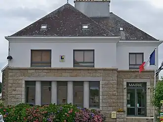 The town hall in Sainte-Hélène | |
.svg.png) Coat of arms | |
Location of Sainte-Hélène | |
 Sainte-Hélène  Sainte-Hélène | |
| Coordinates: 47°43′15″N 3°12′12″W / 47.7208°N 3.2033°W | |
| Country | France |
| Region | Brittany |
| Department | Morbihan |
| Arrondissement | Lorient |
| Canton | Pluvigner |
| Intercommunality | Blavet Bellevue Océan |
| Government | |
| • Mayor (2024–2026) | Christèle Perrel[1] |
Area 1 | 8.08 km2 (3.12 sq mi) |
| Population (2022)[2] | 1,298 |
| • Density | 160/km2 (420/sq mi) |
| Time zone | UTC+01:00 (CET) |
| • Summer (DST) | UTC+02:00 (CEST) |
| INSEE/Postal code | 56220 /56700 |
| Elevation | 0–20 m (0–66 ft) |
| 1 French Land Register data, which excludes lakes, ponds, glaciers > 1 km2 (0.386 sq mi or 247 acres) and river estuaries. | |
Sainte-Hélène (French pronunciation: [sɛ̃t elɛn] ⓘ; Breton: Santez-Elen) is a commune in the Morbihan department of Brittany in north-western France.[3] Inhabitants of Sainte-Hélène are called in French Hélénois.
Economy
The area is primarily an agricultural community, but also relies increasingly on the tourist industry, offering a range of 'gîte' accommodation and attracting visitors to the Étel estuary area.
See also
References
- ^ "Répertoire national des élus: les maires" (in French). data.gouv.fr, Plateforme ouverte des données publiques françaises. 12 March 2025.
- ^ "Populations de référence 2022" (in French). The National Institute of Statistics and Economic Studies. 19 December 2024.
- ^ INSEE commune file
External links
Wikimedia Commons has media related to Sainte-Hélène (Morbihan).
- Base Mérimée: Search for heritage in the commune, Ministère français de la Culture. (in French)
- Official website (in French)
- Mayors of Morbihan Association (in French)