Cottance
Cottance | |
|---|---|
Commune | |
 | |
.svg.png) Coat of arms | |
Location of Cottance | |
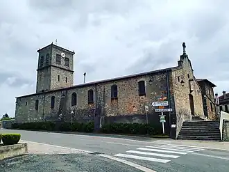
 Cottance  Cottance | |
| Coordinates: 45°47′39″N 4°17′59″E / 45.7942°N 4.2997°E | |
| Country | France |
| Region | Auvergne-Rhône-Alpes |
| Department | Loire |
| Arrondissement | Montbrison |
| Canton | Feurs |
| Government | |
| • Mayor (2020–2026) | Jacques de Lemps[1] |
Area 1 | 13.55 km2 (5.23 sq mi) |
| Population (2022)[2] | 753 |
| • Density | 56/km2 (140/sq mi) |
| Time zone | UTC+01:00 (CET) |
| • Summer (DST) | UTC+02:00 (CEST) |
| INSEE/Postal code | 42073 /42360 |
| Elevation | 403–656 m (1,322–2,152 ft) (avg. 493 m or 1,617 ft) |
| 1 French Land Register data, which excludes lakes, ponds, glaciers > 1 km2 (0.386 sq mi or 247 acres) and river estuaries. | |
Cottance (French pronunciation: [kɔtɑ̃s]) is a commune in the Loire department in central France.
Population
| Year | Pop. | ±% p.a. |
|---|---|---|
| 1968 | 668 | — |
| 1975 | 533 | −3.17% |
| 1982 | 499 | −0.94% |
| 1990 | 487 | −0.30% |
| 1999 | 551 | +1.38% |
| 2009 | 651 | +1.68% |
| 2014 | 689 | +1.14% |
| 2020 | 741 | +1.22% |
| Source: INSEE[3] | ||
See also
References
- ^ "Répertoire national des élus: les maires". data.gouv.fr, Plateforme ouverte des données publiques françaises (in French). 2 December 2020.
- ^ "Populations de référence 2022" (in French). The National Institute of Statistics and Economic Studies. 19 December 2024.
- ^ Population en historique depuis 1968, INSEE
Wikimedia Commons has media related to Cottance.