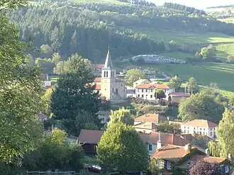
Cherier
Cherier | |
|---|---|
Commune | |
 | |
Location of Cherier | |
 Cherier  Cherier | |
| Coordinates: 45°57′56″N 3°54′37″E / 45.9656°N 3.9103°E | |
| Country | France |
| Region | Auvergne-Rhône-Alpes |
| Department | Loire |
| Arrondissement | Roanne |
| Canton | Renaison |
| Intercommunality | Pays d'Urfé |
| Government | |
| • Mayor (2020–2026) | Charles Laboure[1] |
Area 1 | 28.11 km2 (10.85 sq mi) |
| Population (2022)[2] | 522 |
| • Density | 19/km2 (48/sq mi) |
| Time zone | UTC+01:00 (CET) |
| • Summer (DST) | UTC+02:00 (CEST) |
| INSEE/Postal code | 42061 /42430 |
| Elevation | 594–1,156 m (1,949–3,793 ft) (avg. 824 m or 2,703 ft) |
| 1 French Land Register data, which excludes lakes, ponds, glaciers > 1 km2 (0.386 sq mi or 247 acres) and river estuaries. | |
Cherier (French pronunciation: [ʃəʁje]) is a commune in the Loire department in central France.
Population
| Year | Pop. | ±% p.a. |
|---|---|---|
| 1968 | 647 | — |
| 1975 | 595 | −1.19% |
| 1982 | 542 | −1.32% |
| 1990 | 482 | −1.46% |
| 1999 | 445 | −0.88% |
| 2009 | 477 | +0.70% |
| 2014 | 510 | +1.35% |
| 2020 | 553 | +1.36% |
| Source: INSEE[3] | ||
See also
References
- ^ "Répertoire national des élus: les maires". data.gouv.fr, Plateforme ouverte des données publiques françaises (in French). 2 December 2020.
- ^ "Populations de référence 2022" (in French). The National Institute of Statistics and Economic Studies. 19 December 2024.
- ^ Population en historique depuis 1968, INSEE
Wikimedia Commons has media related to Cherier.