Bieujac
Bieujac | |
|---|---|
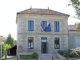 Town hall | |
Location of Bieujac | |
 Bieujac  Bieujac | |
| Coordinates: 44°32′25″N 0°09′14″W / 44.5403°N 0.1539°W | |
| Country | France |
| Region | Nouvelle-Aquitaine |
| Department | Gironde |
| Arrondissement | Langon |
| Canton | Le Sud-Gironde |
| Intercommunality | Sud Gironde |
| Government | |
| • Mayor (2020–2026) | Frédéric Birac[1] |
Area 1 | 6.97 km2 (2.69 sq mi) |
| Population (2022)[2] | 670 |
| • Density | 96/km2 (250/sq mi) |
| Time zone | UTC+01:00 (CET) |
| • Summer (DST) | UTC+02:00 (CEST) |
| INSEE/Postal code | 33050 /33210 |
| Elevation | 13–58 m (43–190 ft) (avg. 26 m or 85 ft) |
| 1 French Land Register data, which excludes lakes, ponds, glaciers > 1 km2 (0.386 sq mi or 247 acres) and river estuaries. | |
Bieujac (French pronunciation: [bjœʒak]) is a commune in the Gironde department in Nouvelle-Aquitaine in southwestern France.
Population
| Year | Pop. | ±% |
|---|---|---|
| 1962 | 341 | — |
| 1968 | 344 | +0.9% |
| 1975 | 280 | −18.6% |
| 1982 | 297 | +6.1% |
| 1990 | 384 | +29.3% |
| 1999 | 416 | +8.3% |
| 2008 | 479 | +15.1% |
See also
References
- ^ "Répertoire national des élus: les maires" (in French). data.gouv.fr, Plateforme ouverte des données publiques françaises. 13 September 2022.
- ^ "Populations de référence 2022" (in French). The National Institute of Statistics and Economic Studies. 19 December 2024.
Wikimedia Commons has media related to Bieujac.