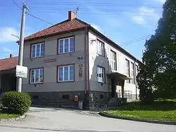
Zelená Hora (Vyškov District)
Zelená Hora | |
|---|---|
 Municipal office | |
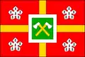 Flag 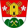 Coat of arms | |
 Zelená Hora Location in the Czech Republic | |
| Coordinates: 49°19′44″N 17°0′49″E / 49.32889°N 17.01361°E | |
| Country | |
| Region | South Moravian |
| District | Vyškov |
| Founded | 1763 |
| Area | |
• Total | 2.96 km2 (1.14 sq mi) |
| Elevation | 368 m (1,207 ft) |
| Population (2025-01-01)[1] | |
• Total | 328 |
| • Density | 110/km2 (290/sq mi) |
| Time zone | UTC+1 (CET) |
| • Summer (DST) | UTC+2 (CEST) |
| Postal code | 683 21 |
| Website | www |
Zelená Hora is a municipality and village in Vyškov District in the South Moravian Region of the Czech Republic. It has about 300 inhabitants.
Zelená Hora lies approximately 8 kilometres (5 mi) north of Vyškov, 33 km (21 mi) north-east of Brno, and 206 km (128 mi) south-east of Prague.
Demographics
| Year | Pop. | ±% |
|---|---|---|
| 1869 | 322 | — |
| 1880 | 420 | +30.4% |
| 1890 | 443 | +5.5% |
| 1900 | 451 | +1.8% |
| 1910 | 541 | +20.0% |
| 1921 | 526 | −2.8% |
| 1930 | 480 | −8.7% |
| 1950 | 259 | −46.0% |
| 1961 | 300 | +15.8% |
| 1970 | 279 | −7.0% |
| 1980 | 265 | −5.0% |
| 1991 | 231 | −12.8% |
| 2001 | 219 | −5.2% |
| 2011 | 240 | +9.6% |
| 2021 | 297 | +23.8% |
| Source: Censuses[2][3] | ||
References
- ^ "Population of Municipalities – 1 January 2025". Czech Statistical Office. 2025-05-16.
- ^ "Historický lexikon obcí České republiky 1869–2011" (in Czech). Czech Statistical Office. 2015-12-21.
- ^ "Population Census 2021: Population by sex". Public Database. Czech Statistical Office. 2021-03-27.
External links
Wikimedia Commons has media related to Zelená Hora (Vyškov District).