Podbřežice
Podbřežice | |
|---|---|
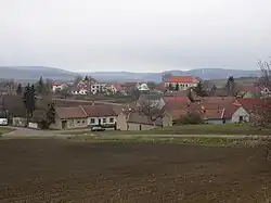 General view | |
 Flag  Coat of arms | |
 Podbřežice Location in the Czech Republic | |
| Coordinates: 49°12′45″N 16°55′41″E / 49.21250°N 16.92806°E | |
| Country | |
| Region | South Moravian |
| District | Vyškov |
| First mentioned | 1348 |
| Area | |
• Total | 3.54 km2 (1.37 sq mi) |
| Elevation | 244 m (801 ft) |
| Population (2025-01-01)[1] | |
• Total | 296 |
| • Density | 84/km2 (220/sq mi) |
| Time zone | UTC+1 (CET) |
| • Summer (DST) | UTC+2 (CEST) |
| Postal code | 683 01 |
| Website | www |
Podbřežice is a municipality and village in Vyškov District in the South Moravian Region of the Czech Republic. It has about 300 inhabitants.
Podbřežice lies approximately 8 kilometres (5 mi) south-west of Vyškov, 24 km (15 mi) east of Brno, and 206 km (128 mi) south-east of Prague.
Demographics
| Year | Pop. | ±% |
|---|---|---|
| 1869 | 281 | — |
| 1880 | 309 | +10.0% |
| 1890 | 318 | +2.9% |
| 1900 | 326 | +2.5% |
| 1910 | 398 | +22.1% |
| 1921 | 378 | −5.0% |
| 1930 | 394 | +4.2% |
| 1950 | 322 | −18.3% |
| 1961 | 304 | −5.6% |
| 1970 | 288 | −5.3% |
| 1980 | 263 | −8.7% |
| 1991 | 217 | −17.5% |
| 2001 | 231 | +6.5% |
| 2011 | 235 | +1.7% |
| 2021 | 239 | +1.7% |
| Source: Censuses[2][3] | ||
References
- ^ "Population of Municipalities – 1 January 2025". Czech Statistical Office. 2025-05-16.
- ^ "Historický lexikon obcí České republiky 1869–2011" (in Czech). Czech Statistical Office. 2015-12-21.
- ^ "Population Census 2021: Population by sex". Public Database. Czech Statistical Office. 2021-03-27.
External links
Wikimedia Commons has media related to Podbřežice.