Trnava (Třebíč District)
Trnava | |
|---|---|
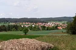 General view | |
 Flag 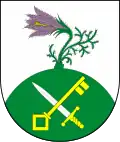 Coat of arms | |
 Trnava Location in the Czech Republic | |
| Coordinates: 49°15′17″N 15°55′27″E / 49.25472°N 15.92417°E | |
| Country | |
| Region | Vysočina |
| District | Třebíč |
| First mentioned | 1101 |
| Area | |
• Total | 12.39 km2 (4.78 sq mi) |
| Elevation | 428 m (1,404 ft) |
| Population (2025-01-01)[1] | |
• Total | 762 |
| • Density | 62/km2 (160/sq mi) |
| Time zone | UTC+1 (CET) |
| • Summer (DST) | UTC+2 (CEST) |
| Postal code | 674 01 |
| Website | www |
Trnava is a municipality and village in Třebíč District in the Vysočina Region of the Czech Republic. It has about 800 inhabitants.
Trnava lies approximately 6 kilometres (4 mi) north-east of Třebíč, 29 km (18 mi) south-east of Jihlava, and 143 km (89 mi) south-east of Prague.
Demographics
| Year | Pop. | ±% |
|---|---|---|
| 1869 | 465 | — |
| 1880 | 519 | +11.6% |
| 1890 | 531 | +2.3% |
| 1900 | 595 | +12.1% |
| 1910 | 665 | +11.8% |
| 1921 | 655 | −1.5% |
| 1930 | 720 | +9.9% |
| 1950 | 589 | −18.2% |
| 1961 | 698 | +18.5% |
| 1970 | 678 | −2.9% |
| 1980 | 661 | −2.5% |
| 1991 | 598 | −9.5% |
| 2001 | 577 | −3.5% |
| 2011 | 589 | +2.1% |
| 2021 | 702 | +19.2% |
| Source: Censuses[2][3] | ||
References
- ^ "Population of Municipalities – 1 January 2025". Czech Statistical Office. 2025-05-16.
- ^ "Historický lexikon obcí České republiky 1869–2011" (in Czech). Czech Statistical Office. 2015-12-21.
- ^ "Population Census 2021: Population by sex". Public Database. Czech Statistical Office. 2021-03-27.
External links
Wikimedia Commons has media related to Trnava (Třebíč District).