Červená Lhota
Červená Lhota | |
|---|---|
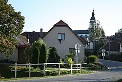 View towards the Church of Saint Lawrence | |
 Flag  Coat of arms | |
 Červená Lhota Location in the Czech Republic | |
| Coordinates: 49°17′4″N 15°48′22″E / 49.28444°N 15.80611°E | |
| Country | |
| Region | Vysočina |
| District | Třebíč |
| First mentioned | 1400 |
| Area | |
• Total | 7.40 km2 (2.86 sq mi) |
| Elevation | 498 m (1,634 ft) |
| Population (2025-01-01)[1] | |
• Total | 185 |
| • Density | 25/km2 (65/sq mi) |
| Time zone | UTC+1 (CET) |
| • Summer (DST) | UTC+2 (CEST) |
| Postal code | 675 07 |
| Website | www |
Červená Lhota is a municipality and village in Třebíč District in the Vysočina Region of the Czech Republic. It has about 200 inhabitants.
Červená Lhota lies approximately 10 kilometres (6 mi) north-west of Třebíč, 20 km (12 mi) south-east of Jihlava, and 134 km (83 mi) south-east of Prague.
Demographics
| Year | Pop. | ±% |
|---|---|---|
| 1869 | 375 | — |
| 1880 | 337 | −10.1% |
| 1890 | 309 | −8.3% |
| 1900 | 343 | +11.0% |
| 1910 | 339 | −1.2% |
| 1921 | 326 | −3.8% |
| 1930 | 323 | −0.9% |
| 1950 | 257 | −20.4% |
| 1961 | 259 | +0.8% |
| 1970 | 232 | −10.4% |
| 1980 | 221 | −4.7% |
| 1991 | 207 | −6.3% |
| 2001 | 188 | −9.2% |
| 2011 | 186 | −1.1% |
| 2021 | 177 | −4.8% |
| Source: Censuses[2][3] | ||
References
- ^ "Population of Municipalities – 1 January 2025". Czech Statistical Office. 2025-05-16.
- ^ "Historický lexikon obcí České republiky 1869–2011" (in Czech). Czech Statistical Office. 2015-12-21.
- ^ "Population Census 2021: Population by sex". Public Database. Czech Statistical Office. 2021-03-27.
External links
Wikimedia Commons has media related to Červená Lhota.