Čechočovice
Čechočovice | |
|---|---|
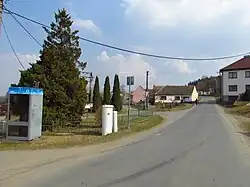 Centre of Čechočovice | |
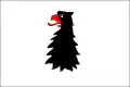 Flag 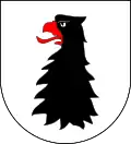 Coat of arms | |
 Čechočovice Location in the Czech Republic | |
| Coordinates: 49°12′10″N 15°47′37″E / 49.20278°N 15.79361°E | |
| Country | |
| Region | Vysočina |
| District | Třebíč |
| First mentioned | 1358 |
| Area | |
• Total | 3.94 km2 (1.52 sq mi) |
| Elevation | 495 m (1,624 ft) |
| Population (2025-01-01)[1] | |
• Total | 346 |
| • Density | 88/km2 (230/sq mi) |
| Time zone | UTC+1 (CET) |
| • Summer (DST) | UTC+2 (CEST) |
| Postal code | 675 22 |
| Website | www |
Čechočovice is a municipality and village in Třebíč District in the Vysočina Region of the Czech Republic. It has about 300 inhabitants.
Čechočovice lies approximately 7 kilometres (4 mi) west of Třebíč, 27 km (17 mi) south-east of Jihlava, and 140 km (87 mi) south-east of Prague.
Demographics
| Year | Pop. | ±% |
|---|---|---|
| 1869 | 254 | — |
| 1880 | 218 | −14.2% |
| 1890 | 236 | +8.3% |
| 1900 | 248 | +5.1% |
| 1910 | 263 | +6.0% |
| 1921 | 299 | +13.7% |
| 1930 | 341 | +14.0% |
| 1950 | 343 | +0.6% |
| 1961 | 346 | +0.9% |
| 1970 | 339 | −2.0% |
| 1980 | 313 | −7.7% |
| 1991 | 295 | −5.8% |
| 2001 | 283 | −4.1% |
| 2011 | 265 | −6.4% |
| 2021 | 322 | +21.5% |
| Source: Censuses[2][3] | ||
References
- ^ "Population of Municipalities – 1 January 2025". Czech Statistical Office. 2025-05-16.
- ^ "Historický lexikon obcí České republiky 1869–2011" (in Czech). Czech Statistical Office. 2015-12-21.
- ^ "Population Census 2021: Population by sex". Public Database. Czech Statistical Office. 2021-03-27.
External links
Wikimedia Commons has media related to Čechočovice.