Svatojanský Újezd
Svatojanský Újezd | |
|---|---|
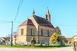 Church of Saint John the Baptist | |
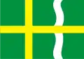 Flag 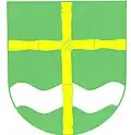 Coat of arms | |
 Svatojanský Újezd Location in the Czech Republic | |
| Coordinates: 50°25′34″N 15°32′35″E / 50.42611°N 15.54306°E | |
| Country | |
| Region | Hradec Králové |
| District | Jičín |
| First mentioned | 1354 |
| Area | |
• Total | 5.34 km2 (2.06 sq mi) |
| Elevation | 321 m (1,053 ft) |
| Population (2025-01-01)[1] | |
• Total | 95 |
| • Density | 18/km2 (46/sq mi) |
| Time zone | UTC+1 (CET) |
| • Summer (DST) | UTC+2 (CEST) |
| Postal code | 507 81 |
| Website | svatojanskyujezd |
Svatojanský Újezd is a municipality and village in Jičín District in the Hradec Králové Region of the Czech Republic. It has about 100 inhabitants.
Demographics
| Year | Pop. | ±% |
|---|---|---|
| 1869 | 416 | — |
| 1880 | 388 | −6.7% |
| 1890 | 359 | −7.5% |
| 1900 | 308 | −14.2% |
| 1910 | 294 | −4.5% |
| 1921 | 253 | −13.9% |
| 1930 | 252 | −0.4% |
| 1950 | 192 | −23.8% |
| 1961 | 170 | −11.5% |
| 1970 | 124 | −27.1% |
| 1980 | 99 | −20.2% |
| 1991 | 93 | −6.1% |
| 2001 | 74 | −20.4% |
| 2011 | 87 | +17.6% |
| 2021 | 95 | +9.2% |
| Source: Censuses[2][3] | ||
References
- ^ "Population of Municipalities – 1 January 2025". Czech Statistical Office. 2025-05-16.
- ^ "Historický lexikon obcí České republiky 1869–2011" (in Czech). Czech Statistical Office. 2015-12-21.
- ^ "Population Census 2021: Population by sex". Public Database. Czech Statistical Office. 2021-03-27.
External links
Wikimedia Commons has media related to Svatojanský Újezd.