Rohoznice (Jičín District)
Rohoznice | |
|---|---|
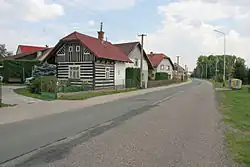 Main street | |
 Rohoznice Location in the Czech Republic | |
| Coordinates: 50°23′30″N 15°41′59″E / 50.39167°N 15.69972°E | |
| Country | |
| Region | Hradec Králové |
| District | Jičín |
| First mentioned | 1267 |
| Area | |
• Total | 8.90 km2 (3.44 sq mi) |
| Elevation | 301 m (988 ft) |
| Population (2025-01-01)[1] | |
• Total | 325 |
| • Density | 37/km2 (95/sq mi) |
| Time zone | UTC+1 (CET) |
| • Summer (DST) | UTC+2 (CEST) |
| Postal code | 507 71 |
| Website | www |
Rohoznice is a municipality and village in Jičín District in the Hradec Králové Region of the Czech Republic. It has about 300 inhabitants.
Demographics
| Year | Pop. | ±% |
|---|---|---|
| 1869 | 672 | — |
| 1880 | 639 | −4.9% |
| 1890 | 637 | −0.3% |
| 1900 | 607 | −4.7% |
| 1910 | 658 | +8.4% |
| 1921 | 663 | +0.8% |
| 1930 | 583 | −12.1% |
| 1950 | 451 | −22.6% |
| 1961 | 417 | −7.5% |
| 1970 | 382 | −8.4% |
| 1980 | 336 | −12.0% |
| 1991 | 310 | −7.7% |
| 2001 | 293 | −5.5% |
| 2011 | 314 | +7.2% |
| 2021 | 321 | +2.2% |
| Source: Censuses[2][3] | ||
References
- ^ "Population of Municipalities – 1 January 2025". Czech Statistical Office. 2025-05-16.
- ^ "Historický lexikon obcí České republiky 1869–2011" (in Czech). Czech Statistical Office. 2015-12-21.
- ^ "Population Census 2021: Population by sex". Public Database. Czech Statistical Office. 2021-03-27.
External links
Wikimedia Commons has media related to Rohoznice (Jičín District).