Stradouň
Stradouň | |
|---|---|
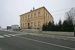 Municipal office | |
 Stradouň Location in the Czech Republic | |
| Coordinates: 49°58′21″N 16°3′56″E / 49.97250°N 16.06556°E | |
| Country | |
| Region | Pardubice |
| District | Ústí nad Orlicí |
| First mentioned | 1160 |
| Area | |
• Total | 5.14 km2 (1.98 sq mi) |
| Elevation | 254 m (833 ft) |
| Population (2025-01-01)[1] | |
• Total | 179 |
| • Density | 35/km2 (90/sq mi) |
| Time zone | UTC+1 (CET) |
| • Summer (DST) | UTC+2 (CEST) |
| Postal code | 538 63 |
| Website | www |
Stradouň is a municipality and village in Ústí nad Orlicí District in the Pardubice Region of the Czech Republic. It has about 200 inhabitants.
Demographics
| Year | Pop. | ±% |
|---|---|---|
| 1869 | 497 | — |
| 1880 | 533 | +7.2% |
| 1890 | 516 | −3.2% |
| 1900 | 513 | −0.6% |
| 1910 | 510 | −0.6% |
| 1921 | 500 | −2.0% |
| 1930 | 468 | −6.4% |
| 1950 | 323 | −31.0% |
| 1961 | 312 | −3.4% |
| 1970 | 274 | −12.2% |
| 1980 | 222 | −19.0% |
| 1991 | 179 | −19.4% |
| 2001 | 163 | −8.9% |
| 2011 | 198 | +21.5% |
| 2021 | 183 | −7.6% |
| Source: Censuses[2][3] | ||
References
- ^ "Population of Municipalities – 1 January 2025". Czech Statistical Office. 2025-05-16.
- ^ "Historický lexikon obcí České republiky 1869–2011" (in Czech). Czech Statistical Office. 2015-12-21.
- ^ "Population Census 2021: Population by sex". Public Database. Czech Statistical Office. 2021-03-27.
External links
Wikimedia Commons has media related to Stradouň.