Sopotnice
Sopotnice | |
|---|---|
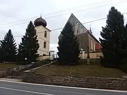 Church of Saint Sigismund with the belfry | |
 Flag  Coat of arms | |
 Sopotnice Location in the Czech Republic | |
| Coordinates: 50°3′33″N 16°20′43″E / 50.05917°N 16.34528°E | |
| Country | |
| Region | Pardubice |
| District | Ústí nad Orlicí |
| First mentioned | 1356 |
| Area | |
• Total | 13.57 km2 (5.24 sq mi) |
| Elevation | 345 m (1,132 ft) |
| Population (2025-01-01)[1] | |
• Total | 938 |
| • Density | 69/km2 (180/sq mi) |
| Time zone | UTC+1 (CET) |
| • Summer (DST) | UTC+2 (CEST) |
| Postal code | 561 15 |
| Website | www |
Sopotnice (German: Sopotnitz) is a municipality and village in Ústí nad Orlicí District in the Pardubice Region of the Czech Republic. It has about 900 inhabitants.
Sopotnice lies approximately 10 kilometres (6 mi) north-west of Ústí nad Orlicí, 41 km (25 mi) east of Pardubice, and 138 km (86 mi) east of Prague.
Demographics
| Year | Pop. | ±% |
|---|---|---|
| 1869 | 1,374 | — |
| 1880 | 1,491 | +8.5% |
| 1890 | 1,505 | +0.9% |
| 1900 | 1,443 | −4.1% |
| 1910 | 1,493 | +3.5% |
| 1921 | 1,462 | −2.1% |
| 1930 | 1,430 | −2.2% |
| 1950 | 1,049 | −26.6% |
| 1961 | 1,087 | +3.6% |
| 1970 | 1,031 | −5.2% |
| 1980 | 1,038 | +0.7% |
| 1991 | 960 | −7.5% |
| 2001 | 932 | −2.9% |
| 2011 | 922 | −1.1% |
| 2021 | 864 | −6.3% |
| Source: Censuses[2][3] | ||
References
- ^ "Population of Municipalities – 1 January 2025". Czech Statistical Office. 2025-05-16.
- ^ "Historický lexikon obcí České republiky 1869–2011" (in Czech). Czech Statistical Office. 2015-12-21.
- ^ "Population Census 2021: Population by sex". Public Database. Czech Statistical Office. 2021-03-27.
External links
Wikimedia Commons has media related to Sopotnice.