Strážkovice
Strážkovice | |
|---|---|
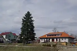 Centre of Strážkovice with the municipal office | |
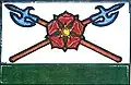 Flag 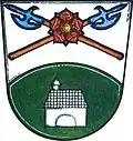 Coat of arms | |
 Strážkovice Location in the Czech Republic | |
| Coordinates: 48°53′59″N 14°34′10″E / 48.89972°N 14.56944°E | |
| Country | |
| Region | South Bohemian |
| District | České Budějovice |
| First mentioned | 1394 |
| Area | |
• Total | 10.07 km2 (3.89 sq mi) |
| Elevation | 535 m (1,755 ft) |
| Population (2025-01-01)[1] | |
• Total | 535 |
| • Density | 53/km2 (140/sq mi) |
| Time zone | UTC+1 (CET) |
| • Summer (DST) | UTC+2 (CEST) |
| Postal code | 374 01 |
| Website | www |
Strážkovice is a municipality and village in České Budějovice District in the South Bohemian Region of the Czech Republic. It has about 500 inhabitants.
Strážkovice lies approximately 12 kilometres (7 mi) south-east of České Budějovice and 133 km (83 mi) south of Prague.
Administrative division
Strážkovice consists of three municipal parts (in brackets population according to the 2021 census):[2]
- Strážkovice (428)
- Lomec (63)
- Řevňovice (29)
Demographics
| Year | Pop. | ±% |
|---|---|---|
| 1869 | 545 | — |
| 1880 | 607 | +11.4% |
| 1890 | 661 | +8.9% |
| 1900 | 646 | −2.3% |
| 1910 | 634 | −1.9% |
| 1921 | 599 | −5.5% |
| 1930 | 567 | −5.3% |
| 1950 | 461 | −18.7% |
| 1961 | 446 | −3.3% |
| 1970 | 385 | −13.7% |
| 1980 | 372 | −3.4% |
| 1991 | 334 | −10.2% |
| 2001 | 345 | +3.3% |
| 2011 | 425 | +23.2% |
| 2021 | 520 | +22.4% |
| Source: Censuses[3][4] | ||
References
- ^ "Population of Municipalities – 1 January 2025". Czech Statistical Office. 2025-05-16.
- ^ "Public Census 2021 – basic data". Public Database (in Czech). Czech Statistical Office. 2022.
- ^ "Historický lexikon obcí České republiky 1869–2011" (in Czech). Czech Statistical Office. 2015-12-21.
- ^ "Population Census 2021: Population by sex". Public Database. Czech Statistical Office. 2021-03-27.
External links
Wikimedia Commons has media related to Strážkovice (České Budějovice District).