Žár
Žár | |
|---|---|
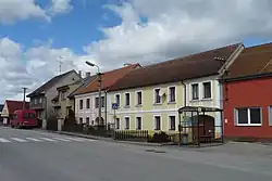 Houses on the main street | |
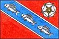 Flag 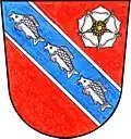 Coat of arms | |
 Žár Location in the Czech Republic | |
| Coordinates: 48°48′25″N 14°42′29″E / 48.80694°N 14.70806°E | |
| Country | |
| Region | South Bohemian |
| District | České Budějovice |
| First mentioned | 1186 |
| Area | |
• Total | 15.06 km2 (5.81 sq mi) |
| Elevation | 518 m (1,699 ft) |
| Population (2025-01-01)[1] | |
• Total | 346 |
| • Density | 23/km2 (60/sq mi) |
| Time zone | UTC+1 (CET) |
| • Summer (DST) | UTC+2 (CEST) |
| Postal code | 374 01 |
| Website | www |
Žár (German: Sohors) is a municipality and village in České Budějovice District in the South Bohemian Region of the Czech Republic. It has about 300 inhabitants.
Žár lies approximately 26 kilometres (16 mi) south-east of České Budějovice and 144 kilometres (89 mi) south of Prague.
Administrative division
Žár consists of three municipal parts (in brackets population according to the 2021 census):[2]
- Žár (249)
- Božejov (23)
- Žumberk (51)
Demographics
| Year | Pop. | ±% |
|---|---|---|
| 1869 | 928 | — |
| 1880 | 954 | +2.8% |
| 1890 | 925 | −3.0% |
| 1900 | 868 | −6.2% |
| 1910 | 828 | −4.6% |
| 1921 | 804 | −2.9% |
| 1930 | 721 | −10.3% |
| 1950 | 400 | −44.5% |
| 1961 | 390 | −2.5% |
| 1970 | 340 | −12.8% |
| 1980 | 286 | −15.9% |
| 1991 | 314 | +9.8% |
| 2001 | 336 | +7.0% |
| 2011 | 318 | −5.4% |
| 2021 | 323 | +1.6% |
| Source: Censuses[3][4] | ||
References
- ^ "Population of Municipalities – 1 January 2025". Czech Statistical Office. 2025-05-16.
- ^ "Public Census 2021 – basic data". Public Database (in Czech). Czech Statistical Office. 2022.
- ^ "Historický lexikon obcí České republiky 1869–2011" (in Czech). Czech Statistical Office. 2015-12-21.
- ^ "Population Census 2021: Population by sex". Public Database. Czech Statistical Office. 2021-03-27.
External links
Wikimedia Commons has media related to Žár.