Hranice (České Budějovice District)
Hranice | |
|---|---|
_01.jpg) Blata, an integral part of Hranice | |
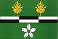 Flag 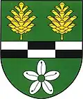 Coat of arms | |
 Hranice Location in the Czech Republic | |
| Coordinates: 48°50′19″N 14°52′6″E / 48.83861°N 14.86833°E | |
| Country | |
| Region | South Bohemian |
| District | České Budějovice |
| Founded | 1790 |
| Area | |
• Total | 7.22 km2 (2.79 sq mi) |
| Elevation | 480 m (1,570 ft) |
| Population (2025-01-01)[1] | |
• Total | 209 |
| • Density | 29/km2 (75/sq mi) |
| Time zone | UTC+1 (CET) |
| • Summer (DST) | UTC+2 (CEST) |
| Postal code | 374 01 |
| Website | www |
Hranice (German: Julienhain) is a municipality and village in České Budějovice District in the South Bohemian Region of the Czech Republic. It has about 200 inhabitants.
Hranice lies approximately 33 kilometres (21 mi) south-east of České Budějovice and 143 km (89 mi) south of Prague.
Administrative division
Hranice consists of two municipal parts (in brackets population according to the 2021 census):[2]
- Hranice (123)
- Trpnouze (64)
Demographics
| Year | Pop. | ±% |
|---|---|---|
| 1869 | 874 | — |
| 1880 | 831 | −4.9% |
| 1890 | 791 | −4.8% |
| 1900 | 841 | +6.3% |
| 1910 | 773 | −8.1% |
| 1921 | 680 | −12.0% |
| 1930 | 572 | −15.9% |
| 1950 | 372 | −35.0% |
| 1961 | 386 | +3.8% |
| 1970 | 327 | −15.3% |
| 1980 | 275 | −15.9% |
| 1991 | 242 | −12.0% |
| 2001 | 243 | +0.4% |
| 2011 | 195 | −19.8% |
| 2021 | 187 | −4.1% |
| Source: Censuses[3][4] | ||
References
- ^ "Population of Municipalities – 1 January 2025". Czech Statistical Office. 2025-05-16.
- ^ "Public Census 2021 – basic data". Public Database (in Czech). Czech Statistical Office. 2022.
- ^ "Historický lexikon obcí České republiky 1869–2011" (in Czech). Czech Statistical Office. 2015-12-21.
- ^ "Population Census 2021: Population by sex". Public Database. Czech Statistical Office. 2021-03-27.
External links
Wikimedia Commons has media related to Hranice (České Budějovice District).