Saint-Maixent
Saint-Maixent | |
|---|---|
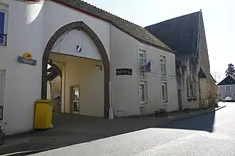 The town hall of Saint-Maixent. | |
Location of Saint-Maixent | |
 Saint-Maixent 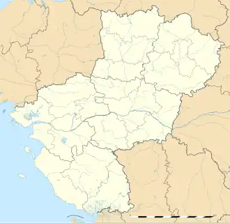 Saint-Maixent | |
| Coordinates: 48°05′23″N 0°39′12″E / 48.0897°N 0.6533°E | |
| Country | France |
| Region | Pays de la Loire |
| Department | Sarthe |
| Arrondissement | Mamers |
| Canton | Saint-Calais |
| Intercommunality | CC du Perche Emeraude |
| Government | |
| • Mayor (2020–2026) | Éric Barbier[1] |
Area 1 | 22.48 km2 (8.68 sq mi) |
| Population (2022)[2] | 741 |
| • Density | 33/km2 (85/sq mi) |
| Demonym(s) | Saint-Maixentais, Saint-Maixentaise |
| Time zone | UTC+01:00 (CET) |
| • Summer (DST) | UTC+02:00 (CEST) |
| INSEE/Postal code | 72296 /72320 |
| Elevation | 75–197 m (246–646 ft) |
| 1 French Land Register data, which excludes lakes, ponds, glaciers > 1 km2 (0.386 sq mi or 247 acres) and river estuaries. | |
Saint-Maixent (French pronunciation: [sɛ̃ mɛksɑ̃]) is a commune in the Sarthe department, in the region of Pays de la Loire, northwestern France.
See also
References
- ^ "Répertoire national des élus: les maires". data.gouv.fr, Plateforme ouverte des données publiques françaises (in French). 2 December 2020.
- ^ "Populations de référence 2022" (in French). The National Institute of Statistics and Economic Studies. 19 December 2024.
Wikimedia Commons has media related to Saint-Maixent.