Précigné
Précigne | |
|---|---|
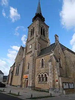 The church of Saint-Pierre | |
Location of Précigne | |
 Précigne 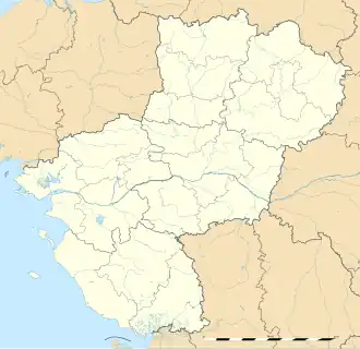 Précigne | |
| Coordinates: 47°45′58″N 0°19′24″W / 47.7661°N 0.3233°W | |
| Country | France |
| Region | Pays de la Loire |
| Department | Sarthe |
| Arrondissement | La Flèche |
| Canton | Sablé-sur-Sarthe |
| Intercommunality | CC Pays Sabolien |
| Government | |
| • Mayor (2020–2026) | Jean-François Zalesny[1] |
Area 1 | 57.85 km2 (22.34 sq mi) |
| Population (2022)[2] | 2,900 |
| • Density | 50/km2 (130/sq mi) |
| Demonym | Précignéens |
| Time zone | UTC+01:00 (CET) |
| • Summer (DST) | UTC+02:00 (CEST) |
| INSEE/Postal code | 72244 /72300 |
| Elevation | 20–60 m (66–197 ft) |
| 1 French Land Register data, which excludes lakes, ponds, glaciers > 1 km2 (0.386 sq mi or 247 acres) and river estuaries. | |
Précigné (French pronunciation: [pʁesiɲe]) is a commune in the Sarthe département in the region of Pays de la Loire in north-western France.
Population
| Year | Pop. | ±% p.a. |
|---|---|---|
| 1968 | 2,145 | — |
| 1975 | 2,111 | −0.23% |
| 1982 | 2,110 | −0.01% |
| 1990 | 2,299 | +1.08% |
| 1999 | 2,645 | +1.57% |
| 2007 | 2,868 | +1.02% |
| 2012 | 3,070 | +1.37% |
| 2017 | 2,973 | −0.64% |
| Source: INSEE[3] | ||
See also
References
- ^ "Répertoire national des élus: les maires". data.gouv.fr, Plateforme ouverte des données publiques françaises (in French). 2 December 2020.
- ^ "Populations de référence 2022" (in French). The National Institute of Statistics and Economic Studies. 19 December 2024.
- ^ Population en historique depuis 1968, INSEE
Wikimedia Commons has media related to Précigné.