Slavětín (Havlíčkův Brod District)
Slavětín | |
|---|---|
_02.jpg) Chapel of Saint Anne | |
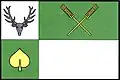 Flag 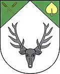 Coat of arms | |
 Slavětín Location in the Czech Republic | |
| Coordinates: 49°40′7″N 15°46′22″E / 49.66861°N 15.77278°E | |
| Country | |
| Region | Vysočina |
| District | Havlíčkův Brod |
| First mentioned | 1314 |
| Area | |
• Total | 2.19 km2 (0.85 sq mi) |
| Elevation | 579 m (1,900 ft) |
| Population (2025-01-01)[1] | |
• Total | 138 |
| • Density | 63/km2 (160/sq mi) |
| Time zone | UTC+1 (CET) |
| • Summer (DST) | UTC+2 (CEST) |
| Postal code | 582 63 |
| Website | obecslavetin |
Slavětín is a municipality and village in Havlíčkův Brod District in the Vysočina Region of the Czech Republic. It has about 100 inhabitants.
Slavětín lies approximately 16 kilometres (10 mi) north-east of Havlíčkův Brod, 34 km (21 mi) north-east of Jihlava, and 108 km (67 mi) south-east of Prague.
Demographics
| Year | Pop. | ±% |
|---|---|---|
| 1869 | 272 | — |
| 1880 | 240 | −11.8% |
| 1890 | 244 | +1.7% |
| 1900 | 265 | +8.6% |
| 1910 | 277 | +4.5% |
| 1921 | 276 | −0.4% |
| 1930 | 250 | −9.4% |
| 1950 | 208 | −16.8% |
| 1961 | 204 | −1.9% |
| 1970 | 189 | −7.4% |
| 1980 | 137 | −27.5% |
| 1991 | 97 | −29.2% |
| 2001 | 95 | −2.1% |
| 2011 | 104 | +9.5% |
| 2021 | 113 | +8.7% |
| Source: Censuses[2][3] | ||
References
- ^ "Population of Municipalities – 1 January 2025". Czech Statistical Office. 2025-05-16.
- ^ "Historický lexikon obcí České republiky 1869–2011" (in Czech). Czech Statistical Office. 2015-12-21.
- ^ "Population Census 2021: Population by sex". Public Database. Czech Statistical Office. 2021-03-27.
External links
Wikimedia Commons has media related to Slavětín (Havlíčkův Brod District).