Radostín (Havlíčkův Brod District)
Radostín | |
|---|---|
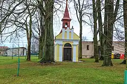 Chapel in the centre of Radostín | |
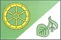 Flag 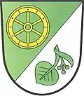 Coat of arms | |
 Radostín Location in the Czech Republic | |
| Coordinates: 49°36′38″N 15°44′7″E / 49.61056°N 15.73528°E | |
| Country | |
| Region | Vysočina |
| District | Havlíčkův Brod |
| First mentioned | 1590 |
| Area | |
• Total | 4.33 km2 (1.67 sq mi) |
| Elevation | 550 m (1,800 ft) |
| Population (2025-01-01)[1] | |
• Total | 144 |
| • Density | 33/km2 (86/sq mi) |
| Time zone | UTC+1 (CET) |
| • Summer (DST) | UTC+2 (CEST) |
| Postal code | 580 01 |
| Website | www |
Radostín is a municipality and village in Havlíčkův Brod District in the Vysočina Region of the Czech Republic. It has about 100 inhabitants.
Radostín lies approximately 7 kilometres (4 mi) north-west of Havlíčkův Brod, 30 km (19 mi) north of Jihlava, and 94 km (58 mi) south-east of Prague.
Demographics
| Year | Pop. | ±% |
|---|---|---|
| 1869 | 157 | — |
| 1880 | 165 | +5.1% |
| 1890 | 154 | −6.7% |
| 1900 | 185 | +20.1% |
| 1910 | 168 | −9.2% |
| 1921 | 181 | +7.7% |
| 1930 | 238 | +31.5% |
| 1950 | 199 | −16.4% |
| 1961 | 215 | +8.0% |
| 1970 | 192 | −10.7% |
| 1980 | 179 | −6.8% |
| 1991 | 158 | −11.7% |
| 2001 | 152 | −3.8% |
| 2011 | 142 | −6.6% |
| 2021 | 159 | +12.0% |
| Source: Censuses[2][3] | ||
References
- ^ "Population of Municipalities – 1 January 2025". Czech Statistical Office. 2025-05-16.
- ^ "Historický lexikon obcí České republiky 1869–2011" (in Czech). Czech Statistical Office. 2015-12-21.
- ^ "Population Census 2021: Population by sex". Public Database. Czech Statistical Office. 2021-03-27.
External links
Wikimedia Commons has media related to Radostín (Havlíčkův Brod District).